Weekend Newsfeed: May’s last weekend brings colder airflow off the Southern Ocean, showers & sunshine
26/05/2024 1:00am

> From the WeatherWatch archives
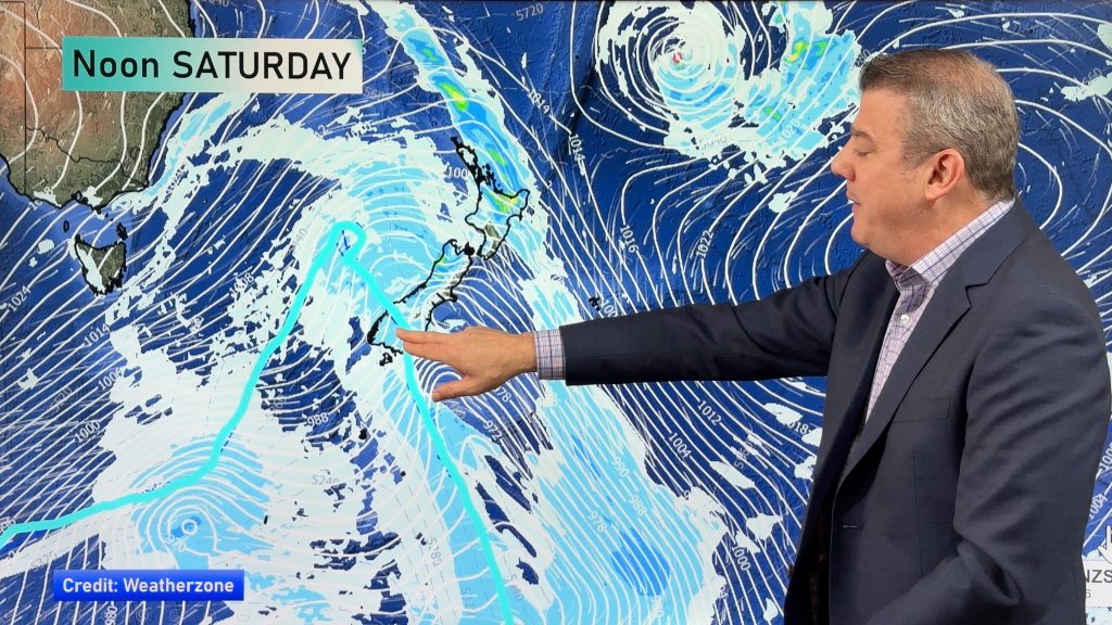
The last weekend of Autumn on the meteorological calendar is upon us and the forecast looks, well, typical for this time of year! Unsettled and that will make some regions colder than average.
A powerful high pressure zone remains south of Australia and between that high and this week’s low pressure zone (now departing from New Zealand) it places a south to south-west flow across our country. This means colder or cooler nights and morning mornings for many regions.
Most affected by the cold – surprise surprise – is Southland, Fiordland and coastal Otago. Single digit maximum temperatures are on the way for a number of southern centres with Gore likely to only reach a high of +6C or 7C on Sunday. The top of NZ is different story, however, with highs 10 to 12 degrees milder.
Many regions have airflows coming off the Southern Ocean, but a small portion of southern NZ may get airflows more directly from Antarctica, which is why it’s so much colder in that very lower portion of the South Island.
But if you’re sheltered from a southerly or south-westerly then look forward to some sunshine.

- Maps powered by WeatherZone – Graphics by WeatherWatch
- WeatherWatch.co.nz
Comments
Before you add a new comment, take note this story was published on 26 May 2024.
Latest Video
NZ: High pressure slips away, wintry snap for some late week/Saturday
High pressure is still over New Zealand but it will slip away to the east this week allowing for West…
Related Articles
NZ: High pressure slips away, wintry snap for some late week/Saturday
High pressure is still over New Zealand but it will slip away to the east this week allowing for West…

ClimateWatch: May outlook & El Niño discussion
Everyone is talking about El Niño so in this month’s update we discuss when it may be forming and what…
Foggy weather off & on next couple of weeks
High pressure in Autumn usually leads to fog and our unique fog forecaster can better help you plan ahead, especially…


Add new comment
steve sole on 25/05/2024 11:35pm
absolutely rubbish
Reply