NZ VIDEO: Frosty high incoming, windy westerlies possible in a week
20/08/2025 11:03pm
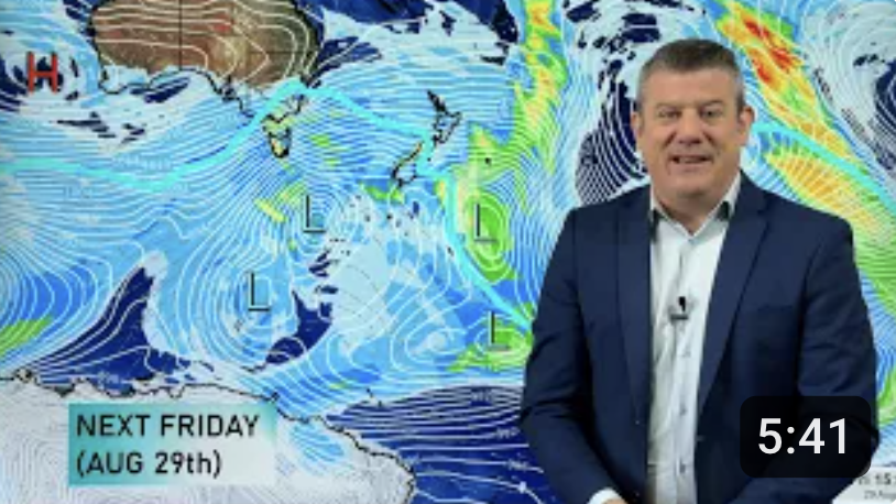
Powerful high pressure is moving in and over the South Island this weekend bringing more frosty nights and cold mornings around the nation.
Some cloud and showers continue in the east and south, along with a windier southerly flow. Over the weekend and early next week easterlies may well develop at the top of the North Island bringing some showers.
But later next week we may be seeing what looks more like an early spring pattern with strong westerlies moving in.
We’ll have more details about that in our Friday update and obviously early next week too.
Comments
Latest Video

Unsettled Thu/Fri, high pressure returns this weekend & next week
Wind and some wet weather is moving into both ends of NZ today and tomorrow bringing broken up rain bands…
Related Articles
Unsettled Thu/Fri, high pressure returns this weekend & next week
Wind and some wet weather is moving into both ends of NZ today and tomorrow bringing broken up rain bands…
Subtropical low, windy for some, then high pressure slowly returns
It’s cloudy and windy for parts of New Zealand today with the North Island especially gloomy under cloud associated with…

Temperatures to lift, before dropping again this weekend
Subtropical and north-west winds will help boost temperatures around NZ both by day and night followed a colder couple of…


Add new comment
Millsy on 24/08/2025 3:27am
Why the bad weather?
Reply
Jacques on 26/08/2025 10:36pm
You ask the same question every week. It’s because it’s winter.
Reply