VIDEO: NZ’s forecast through to Monday next week
4/11/2024 10:56pm

> From the WeatherWatch archives
We have more cold fronts and windy westerly gales – but also an uptick in high pressure.
🎆For Guy Fawkes tonight there will be some wet weather around central NZ – but most regions don’t have much wind, which is a positive.
🏇🏽If you’re following the Melbourne Cup, conditions look dry and warm/hot in Melbourne later this afternoon.
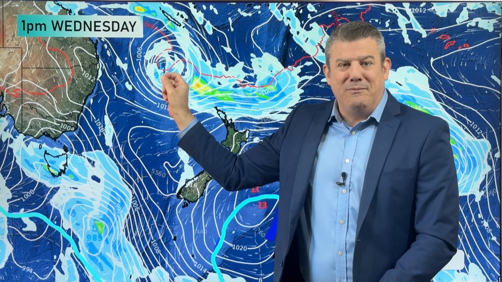
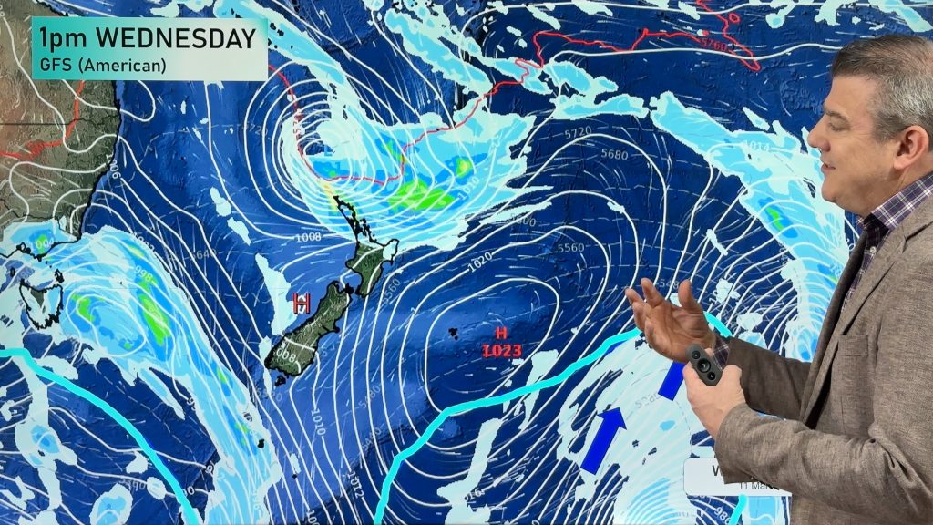
Basically high pressure dominates NZ on Wednesday and weakens the front that is trying to move up NZ.
On Thursday some downpours develop over the North Island with isolated thunderstorms.
Windy weather from the west kicks back in on Friday and spreads more nationwide on Sunday, easing back next week – ahead of the next spring cold front.
Comments
Before you add a new comment, take note this story was published on 4 Nov 2024.
Latest Video

Temperatures to lift, before dropping again this weekend
Subtropical and north-west winds will help boost temperatures around NZ both by day and night followed a colder couple of…
Related Articles
Temperatures to lift, before dropping again this weekend
Subtropical and north-west winds will help boost temperatures around NZ both by day and night followed a colder couple of…
Subtropical low vs subantarctic energy = typical early Autumn setup
A low pressure zone leaving Queensland tonight may brush the very top of the North Island midway through this week…
Subtropical low next week worth monitoring as high pressure controls all
High pressure smothers NZ today and will weaken a little on Sunday and Monday to allow a cooler southerly flow…


Add new comment
Freda on 6/11/2024 9:56am
Excellent weather watch, I really appreciate the way you explain what is happening with the larger picture. Very informative, well done
Reply
WW Forecast Team on 7/11/2024 6:59pm
Thank you Freda! 🙂
– WW
Reply