NZ VIDEO: Frosts & huge high pressure – August kicks off settled
31/07/2025 12:00am
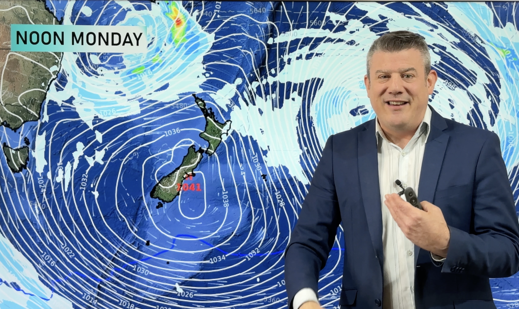
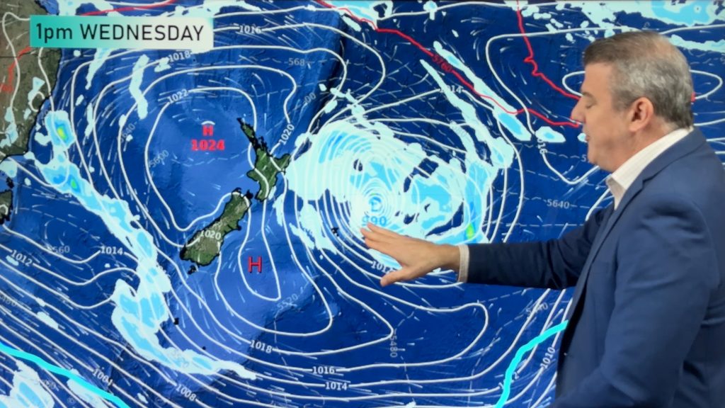
Most places are dry over the weekend ahead – and next week too, as high pressure crosses NZ and dominates. It’s a change from the wet and windy weather New Zealand has had lately.
We have your NZ forecast through to Thursday one week from today.
Programming Notes:
* We have no NZ or Australia video on Friday due to a day-long planned power outage by Vector for where our studio is.
**Our AUGUST ClimateWatch update will be issued early on Friday morning, covering the Big Picture weather forecast going through August. Have a great weekend!
Comments
Latest Video
Rare blood moon lunar eclipse tonight + Yes, NZ’s weather is warming back up again
We had our coldest morning of the year so far today and tonight will also be a little cool (but…
Related Articles
Rare blood moon lunar eclipse tonight + Yes, NZ’s weather is warming back up again
We had our coldest morning of the year so far today and tonight will also be a little cool (but…
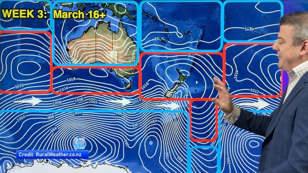
ClimateWatch: MARCH is looking quite orderly to start with
Storms near Antarctica, Autumn’s westerlies building south of Australia & NZ, high pressure again affecting both nations and the tropics…
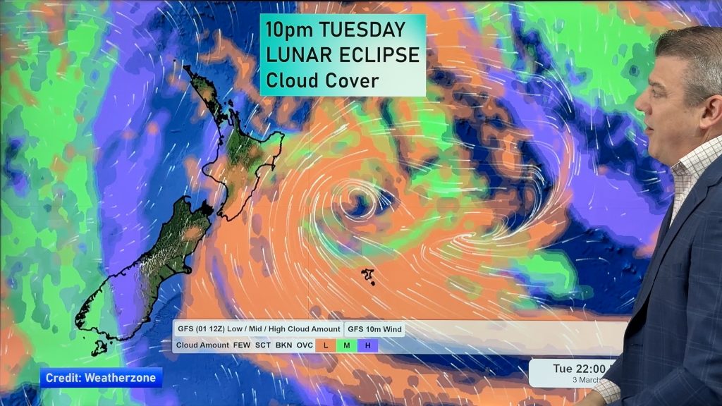
Colder tonight for many, Lunar eclipse Tuesday, high pressure dominates
A lot of low pressure is spinning east of the country while a large high is moving in – this…


Add new comment
Tonz on 2/08/2025 6:08am
Hiha Phil. You were talking about maybe tweaking your frost chart a little and asked how they faired for the 1st & 2nd.
In the main st Takaka morning of the 1st, accurate no frost. For the morning of the 2nd light frost started at dawn.
Reply
Gaz on 1/08/2025 5:28am
Great stuff Phil, again, as usual. Yes it’s quite crap that you can’t use the weather data. but thats politicians for ya!!
Reply
Greg Illing on 31/07/2025 7:52pm
awesome info. enjoy the explanations.
What was the sea/wave data website you spoke about a couple of weeks ago?
Cheers
Reply
WW Forecast Team on 31/07/2025 8:22pm
Hi there Greg, thanks very much for the comment. Here is that site with realtime data: https://www.seascope.io/aotearoa/
Kind regards,
Phil D
Reply