> From the WeatherWatch archives
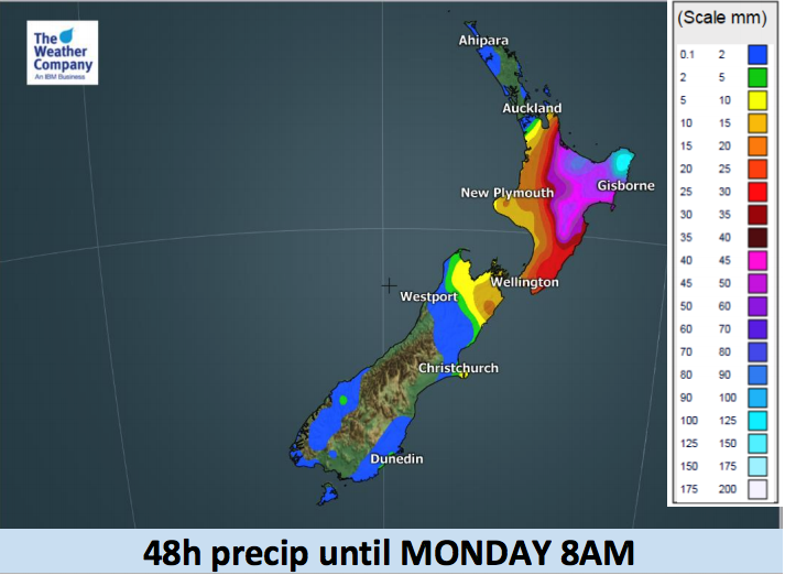
An almost stationary front, located on the fringe of a strong high pressure system to NZ’s east, is staying along the eastern coastline of the country. It’s bringing rainy weather over the eastern North Island, and possibly periods of heavy rain off and on there from Saturday to Monday. Dry and drizzly spells are in the mix too. Showers are spilling over into Bay of Plenty today and also some parts of South Waikato / Central Plateau.
Heavy rain accumulation is expected over the very eastern Bay of Plenty and northern Gisborne areas. Values over 100mm for the next 48 hours are possible in some spots – but it’s patchy with large dry/drizzly areas too.
On Sunday some of this rain moves west further into Waikato and south towards the upper South Island by night, yet the exact location and timing of the rain/showers is largely uncertain given the notable disagreement among computer models. This is not a strong set up, but the East Cape/Gisborne area is exposed to rain being fuelled directly by a sub-tropical nor’easter.
It will be mostly sunny in Northland and Auckland today yet periods of rain or showers are possible on Sunday – but may stay dry over Northland – so a fine line and some areas may just become cloudy and stay dry, or get only a few spits.
Sunniest weather this weekend will be in the Far North and Deep South.

– WeatherWatch.co.nz
Comments
Before you add a new comment, take note this story was published on 3 Aug 2018.


Add new comment