Another cold blast this weekend + Christmas Day weather
17/12/2025 11:31pm
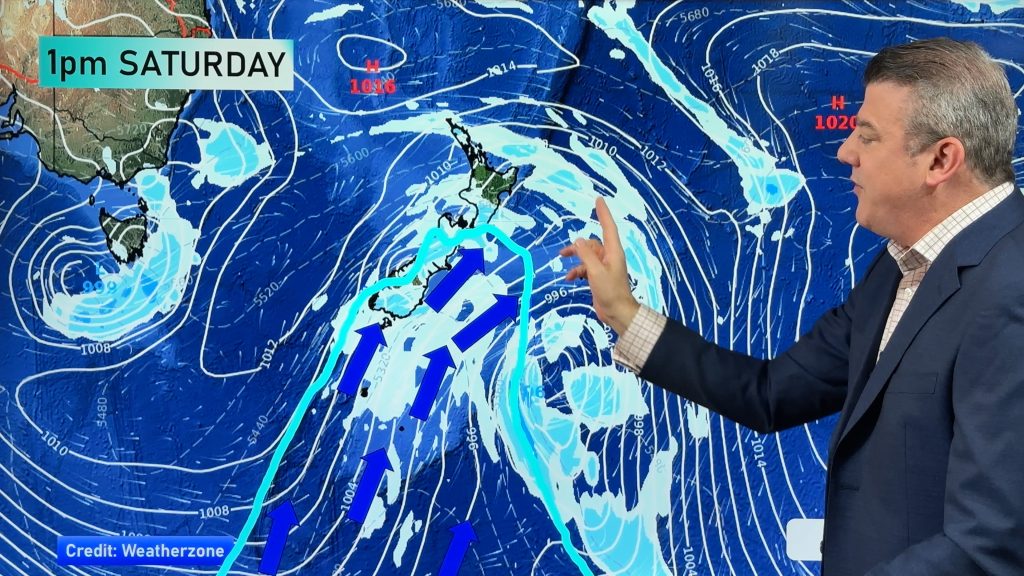
As we’ve been saying for several weeks now, we have a spring-like pattern going through December, but with summer-like temperatures. By that we mean windy, changeable, weather with injections of cold, but otherwise still plenty of hot days – especially in the east and north of the country.
But over the coming week we do see some cold air, with the chance of snow on the mountains this weekend in the South Island and even frosts in some areas (at higher elevation).
All of NZ will feel the cooler airflow, which for some will be cold, others more refreshing.
We also have the latest on Christmas Eve and Christmas Day – the very unsettled weather pattern south of New Zealand and Australia is making it harder to lock in the forecast yet, but we have the latest.
Comments
Latest Video

NZ Easter Weather Update + monitoring the tropics for storm potential
High pressure smothers New Zealand as we head into the long weekend bringing mostly dry weather and light winds, with…
Related Articles
NZ Easter Weather Update + monitoring the tropics for storm potential
High pressure smothers New Zealand as we head into the long weekend bringing mostly dry weather and light winds, with…

ClimateWatch: APRIL’s outlook as La Niña ends, shift to NEUTRAL
La Niña is officially over and now we’re in a “neutral” period of weather for the month of April, which usually…

NZ & South Pacific: Big Picture forecast for Easter + cyclone potential in tropics
Today’s video is a “Big Picture” one covering New Zealand and the south-west Pacific through to Wednesday of next week,…


Add new comment
G Neil on 18/12/2025 12:30am
Why does this La Nina look more like an El Nino in Northland. No rain and westerlies every day. Only 8ml of rain this month.
Reply
WW Forecast Team on 18/12/2025 1:55am
Hi there, basically because La Nina is only very weak, and measured a long way from NZ (at the equator, north of Tahiti). The more dominant driver of our NZ weather this month is mostly coming from south of NZ and Australia. When you have lows south of us, highs north of us – it makes windy westerlies, and that’s also what El Nino does… it creates an ongoing spring (but with summer heat) and can lower rainfall in northern and eastern NZ). There’s still some chance a subtropical low will bring you some rain within the next two weeks.
– WW
Reply