Wintry change for some, windy and warm for others
18/12/2025 11:18pm
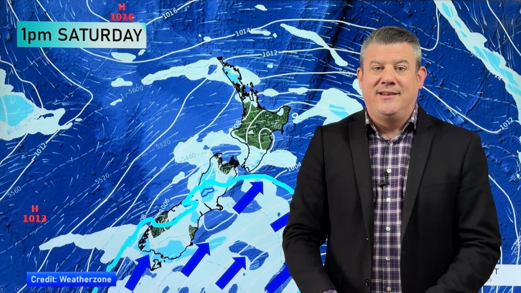
A cold snap is moving up NZ today and Saturday, before easing Sunday and clearing most places on Monday – it will bring a drop in temperatures nationwide, a burst of windy weather, some rain/showers and isolated thunderstorms, and a dusting of snow on the Southern Alps, maybe even some on the highest North Island mountains.
There is also a frost risk this weekend and on Monday morning in some regions.
Next week the westerlies crank back up again – boosting the heat in the east, especially the eastern North Island.
Christmas Eve, Christmas Day and Boxing Day all look similar – westerlies may be blowing in the north and central areas, some West Coast rain (and western North Island isolated showers) and colder air stuck around the lower third of the South Island. This is still not locked in yet – but the forecast is becoming clearer.
We also have a 7 day rainfall map to make sense of it all.
TROPICS:
Today’s video also talks a bit more about the South Pacific Islands – where easterlies and a few showers and thunderstorms are forecast, but no low pressure zones to be concerned about as of this stage.
Comments
Latest Video

NZ Easter Weather Update + monitoring the tropics for storm potential
High pressure smothers New Zealand as we head into the long weekend bringing mostly dry weather and light winds, with…
Related Articles
NZ Easter Weather Update + monitoring the tropics for storm potential
High pressure smothers New Zealand as we head into the long weekend bringing mostly dry weather and light winds, with…

ClimateWatch: APRIL’s outlook as La Niña ends, shift to NEUTRAL
La Niña is officially over and now we’re in a “neutral” period of weather for the month of April, which usually…

NZ & South Pacific: Big Picture forecast for Easter + cyclone potential in tropics
Today’s video is a “Big Picture” one covering New Zealand and the south-west Pacific through to Wednesday of next week,…


Add new comment
Greg on 19/12/2025 2:05am
PD! Your a legend! Been watching you for years. Send me some decent Xmas day weather to Mangawhai please and also Merry Xmas to you!
Reply
WW Forecast Team on 23/12/2025 12:41am
Hey Greg, thanks heaps! Much appreciated. Have a great time at Managawaha and Merry Christmas to you and your family 🙂
Phil D
Reply