Thursday’s Newsfeed: Low pressure grows, wet weather returns
12/06/2024 5:00pm

> From the WeatherWatch archives
In the week ahead low pressure will dominate NZ but the large and somewhat-lazy nature to it means forecasts will be changeable. The low starts to deepen over the next few days as it spins faster and grows larger, but as we said in our latest weather video the low has a lopsided spin to it and that keeps shifting where severe weather is most likely to be. Also, as the low grows in size it pushes much of the severe weather further out from the centre – and the lower pressure at the centre then creates more instability there. The mountains and ranges of NZ further complicate the already complicated weather pattern across the country. So there are a LOT of moving parts for forecasters (and forecasts) to keep up with.
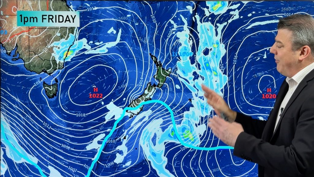
On Friday the low pressure zone(s) will engulf much of the country and the lower air pressure, even if not windy and quite calm, can produce pockets of downpours, some slow moving. This can then break rainfall forecasts, in some cases producing more than is expected. But for many rainfall will be just the usual for a day in winter.
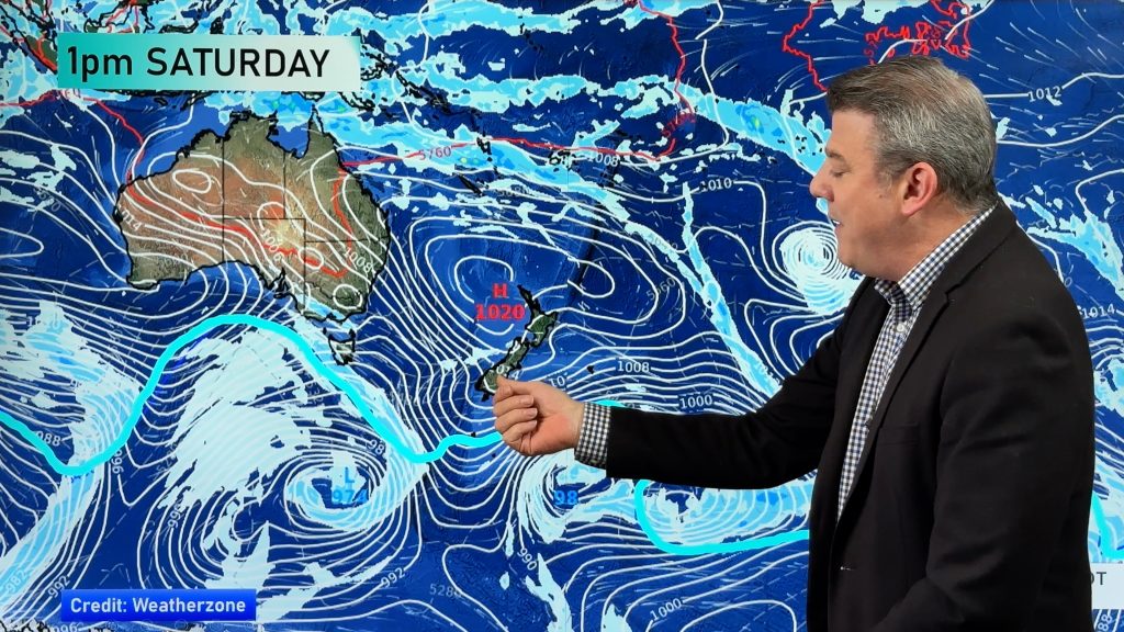
This weekend larger dry, calm, areas may develop with sunny spells – this is due to the low drifting back westwards towards Tasmania and shifting a large portion of the gales south and west of New Zealand out at sea.
It can be confusing with so much change in the maps and models – so to make more sense of it all the “Trends” in our new WeatherWatch app (or at RuralWeather.co.nz) show the forecasts in graph form – and this data updates hourly. It may be a better way to absorb start, peak and end to rainfall times, wind gusts, fog risks and frost potential.


MetService will also have watches and possible warnings – but the goal posts may keep shifting due to the nature of this low.
The coldest portion of this low (with a wintry south-easterly wind flow) will be mostly out over the Tasman Sea, while a warmer sub-tropical or northerly flow feeds in east of the country over the Pacific, joining forces south of NZ.
High pressure this weekend well south of New Zealand will shut down the cold south-east flow and this should see the low weaken further into next week. But next week the low may still linger and bring pockets of severe weather. Put simply – it’s complicated.
Our Thursday weather video will have much more detail about what is happening in the coming days and next week too.


- WeatherWatch.co.nz
Comments
Before you add a new comment, take note this story was published on 12 Jun 2024.
Latest Video
A few temperature swings, a subtropical low & subantarctic airflows
High pressure dominates much of NZ to kick off this week – and likely returns again this weekend – but…
Related Articles
A few temperature swings, a subtropical low & subantarctic airflows
High pressure dominates much of NZ to kick off this week – and likely returns again this weekend – but…
Hot & dry for many + Tropical Cyclone potential next week near Solomons/Vanuatu
The first tropical cyclone of the South Pacific Cyclone season may be forming next week well north of NZ with…
Drier weather returning, warmer too + some tropical trouble brewing
High pressure is moving closer to NZ today, pushing away yesterday’s downpours and thunderstorms well offshore east of the country,…


Add new comment