Temperature trends – Cold front brings cold over temperatures in the south
6/10/2020 3:00am

> From the WeatherWatch archives
A cold front passing northwards over the South Island today leaves cold overnight temperatures in it’s wake. They won’t get terribly cold though but lows may get to about 0 degrees for the Mackenzie Country, getting down to 2 or 3 degrees for a slightly broader area about Canterbury and Otago where skies are clear and winds light.
Tonight’s warmest overnight low will likely be about the western North Island somewhere between Taranaki and Wellington around 11 to 12 degrees, an outside chance Hawkes Bay may pip those temperatures a touch if a northwest stays consistent enough overnight.

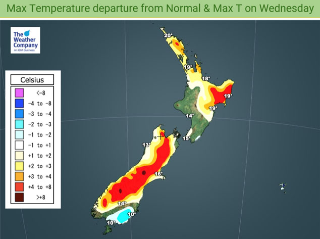
We have two fronts crossing the country on Wednesday, before these fronts move in temperatures will becoming warmer than normal for some areas. This is the case for the upper North Island with highs reaching into the late teens or early twenties, late afternoon or evening the cool down happens as winds change to the southwest. Showers about the lower South Island spread northwards reaching Banks Peninsula late afternoon / evening, temperatures will naturally be warmer before this change comes through. Inland spots will especially be warmer than normal.

For Max & Min NZ Temperature maps for the next few days and nights ahead, please visit our new maps page: https://www.weatherwatch.co.nz/maps-radars/temperature/temperature
By Weather Analyst Aaron Wilkinson – WeatherWatch.co.nz
Comments
Before you add a new comment, take note this story was published on 6 Oct 2020.


Add new comment