Storm Update: Severe gales surge off & on across NZ next few days (+8 Maps)
27/09/2020 7:02pm

> From the WeatherWatch archives
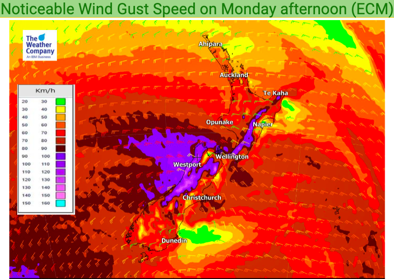
Waves of gales force winds will be surging across New Zealand for the next two days and with the storm south of New Zealand now peaking in depth we can expect those wind directions to shift a little. Winds will be turning more south west on Tuesday and ramping up for one last blast before it eases on Wednesday. They may briefly turn NW before this occurs.
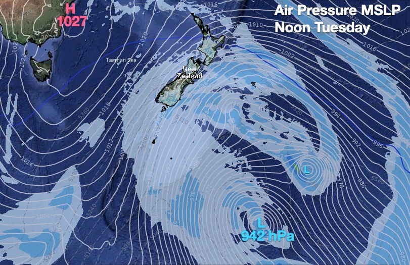
WeatherWatch.co.nz says that as of Monday morning the storm had an estimated central air pressure (Based on high resolution ECMWF modelling) of 933hPa. This would make it a more powerful storm air-pressure-wise than Hurricane Laura was, which recently hit the United States and was a Category 4 Atlantic hurricane for a time. (937hPa).
Head forecaster Philip Duncan says the air pressure will remain very low for a few more days. “The storm is peaking right now across Monday but it lies several hundred kilometres south east of New Zealand over the Southern Ocean. It’s this position that allows it to dredge up the Antarctic blast for the South Island in particular”.
Mr Duncan says thankfully this storm is not directly hitting New Zealand but it’s so large it is bringing severe gales, hail, heavy rain across parts of New Zealand and sub-zero Antarctic wind chills in the south.
All MetService weather warnings can now be found here: www.weatherwatch.co.nz/maps-radars/warnings/metservice
All wind maps can be found here: www.weatherwatch.co.nz/maps-radars/wind/current-wind
Refer to www.RuralWeather.co.nz for more information on wind gusts and wind speeds with graphs and hourly data bringing it to life.


WeatherWatch.co.nz – For news, maps, video and local forecasts
www.RuralWeather.co.nz – For the largest local weather data website on earth!
Comments
Before you add a new comment, take note this story was published on 27 Sep 2020.


Add new comment