Monday’s ‘cold’ change only resets temperatures to normal (+2 Maps)
12/05/2019 11:27pm

> From the WeatherWatch archives
Despite a much cooler south west flow over New Zealand today temperatures in most places are still either above average or bang on average for this time of the year.
There are two exceptions, around Otago and Wairarapa – both of these areas are hovering around normal to below normal, especially Otago.
But much of the West Coast and upper North Island remain above normal today, even if only by a degree or two while all other regions are experiencing average daytime highs – this despite the southerly change.
WeatherWatch.co.nz Head forecaster Philip Duncan says this highlights just how much warmer than average it’s been in recent days. “Last week’s set up was mostly sub-tropical, airflows coming from near Fiji and New Caledonia. This week we have more localised southerly flows from just south of NZ and it’s reset temperatures to normal, rather than making it bitterly cold or colder than normal”.
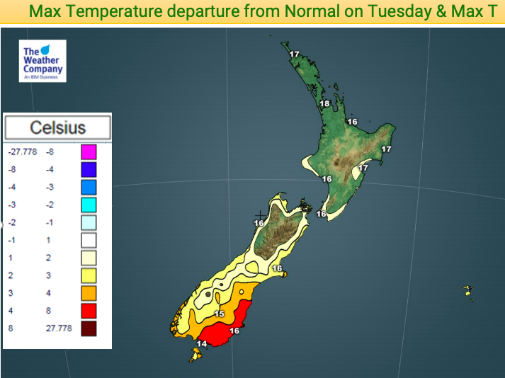
On Tuesday, as the west to north west winds develop again over the South Island, it will make for a warmer than average day once again by as much as several degrees above normal for the lower and eastern South Island. The North Island has a fairly average Tuesday afternoon temperaturewise.


– WeatherWatch.co.nz
Comments
Before you add a new comment, take note this story was published on 12 May 2019.


Add new comment