VIDEO: NZ – Large Tasman Sea low to bring downpours, thunderstorms
9/06/2025 12:39am

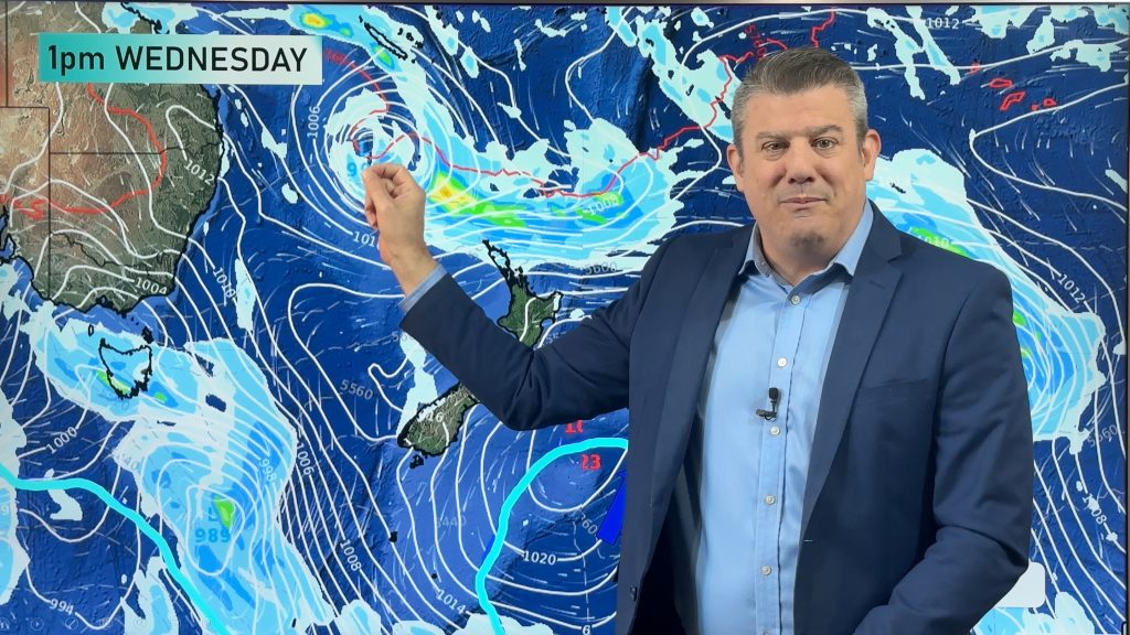
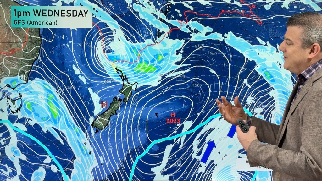
High pressure briefly crosses NZ on Tuesday ahead of more downpours, isolated thunderstorms and wet weather thanks to a large low sitting in the Tasman Sea.
Due to all the high pressure surrounding this low it has a slow journey to NZ and lingers into the weekend as it morphs into a different system. There are large dry areas this week – especially in the east and south of NZ, but western and northern parts of both main islands have the risk of some heavy rain and thunderstorms (possibly severe).
We have your NZ forecast (+ 7 day rainfall) through until Sunday.
Comments
Latest Video

Temperatures to lift, before dropping again this weekend
Subtropical and north-west winds will help boost temperatures around NZ both by day and night followed a colder couple of…
Related Articles
Temperatures to lift, before dropping again this weekend
Subtropical and north-west winds will help boost temperatures around NZ both by day and night followed a colder couple of…
Subtropical low vs subantarctic energy = typical early Autumn setup
A low pressure zone leaving Queensland tonight may brush the very top of the North Island midway through this week…
Subtropical low next week worth monitoring as high pressure controls all
High pressure smothers NZ today and will weaken a little on Sunday and Monday to allow a cooler southerly flow…


Add new comment