VIDEO: Thundery downpours this week, high pressure increases next week
9/06/2025 10:34pm

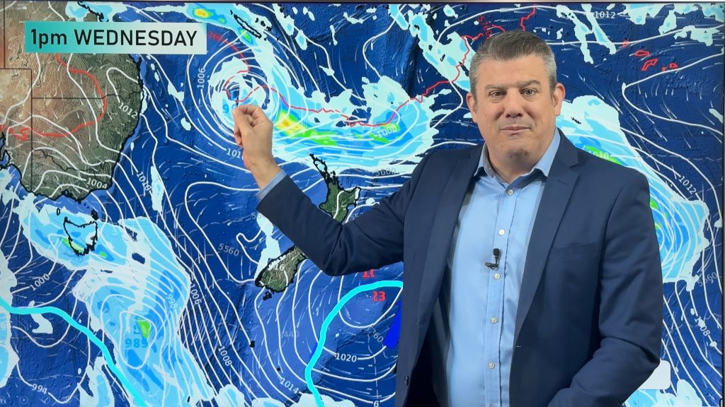
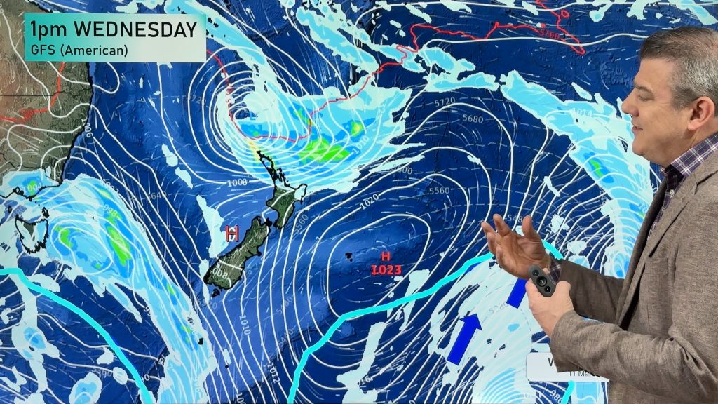
A large low out over the Tasman Sea is set to bring areas of rain, downpours and some thunderstorms over the coming days as the low moves in – but then falls apart over the weekend.
Colder and drier air remains in the south – and that colder airflow moves up into the lower and eastern North Island going through the weekend and the start of next week.
Despite some showers lingering next week, high pressure out of Australia is expected to grow in the NZ area.
Comments
Latest Video

Temperatures to lift, before dropping again this weekend
Subtropical and north-west winds will help boost temperatures around NZ both by day and night followed a colder couple of…
Related Articles
Temperatures to lift, before dropping again this weekend
Subtropical and north-west winds will help boost temperatures around NZ both by day and night followed a colder couple of…
Subtropical low vs subantarctic energy = typical early Autumn setup
A low pressure zone leaving Queensland tonight may brush the very top of the North Island midway through this week…
Subtropical low next week worth monitoring as high pressure controls all
High pressure smothers NZ today and will weaken a little on Sunday and Monday to allow a cooler southerly flow…


Add new comment
Neville Williams on 10/06/2025 7:44am
Hi Phil,
You guys are my ‘go to’ for weather info that is both informative, innovative and comprehensive.
Can you or the team explain how our weather, particularly in north of Nth Island seems to dragging down all these heavy downpours and floods some of us, more frequently?
It appears as though High pressure systems are slamming into the centre of Nth Island and after passing over their back side drags down tropical air onto the front of the lows behind, creating these convergence zones, with what now seems to be almost weekly occurrences of heavy downpours, with the dreaded thunder & lightening watches which seem to always posted for somewhere in the country.
I cannot remember in years gone by, where we have had so many warnings/watches/ or orange or red warnings posted.
It’s starting to become a bit mentally triggering to see all this happening, especially as I have been on the receiving end of some of this weather and the resulting flooding in Auckland area.
Have the weather systems (i.e. high pressure systems) moved north somewhat to create this and is this part of climate change or La Nina or El Nino, swinging a wet wrecking ball at our country?
Can you explain if in weather forecasting circles there has been a fundamental shift in weather pattern and if it is linked to a changing climate model?
Reply
josh on 10/06/2025 10:08pm
yes its 2023 aLL OVER AGAIN IN AUCKLAND. BUT AS THE WW TEAM HAS EXPLAINED, INSTABILITY IS THE KEY.
Reply