VIDEO: More thundery downpours, easing Friday, cooler air Sun/Mon
10/06/2025 10:40pm

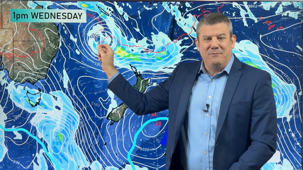
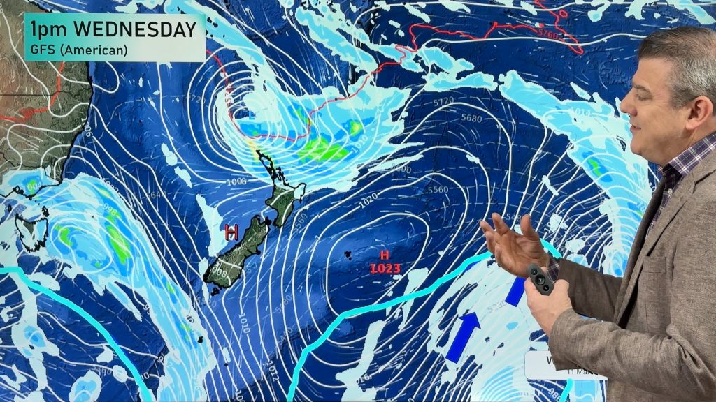
Downpours, some with lightning and thunder, will continue across western parts of the North Island and some western/north-western parts of the South Island as a large low pressure zone in the Tasman Sea slowly drifts in – and then falls apart.
The thundery downpours will ease by the end of Friday, although a few isolated heavy showers may remain in the north and perhaps the east of the North Island going into the weekend. Many other places are drier this weekend as high pressure starts to expand – and that will send the colder air from the lower South Island up into the North Island for early next week – fuelled by sou-east winds in the North Island (and light winds over much of the South Island).
We have your forecast to Tuesday next week.
*Programming note – We have no video on Thursday due to travel, we’re back again Friday with two videos (NZ and Australia).
Comments
Latest Video

Temperatures to lift, before dropping again this weekend
Subtropical and north-west winds will help boost temperatures around NZ both by day and night followed a colder couple of…
Related Articles
Temperatures to lift, before dropping again this weekend
Subtropical and north-west winds will help boost temperatures around NZ both by day and night followed a colder couple of…
Subtropical low vs subantarctic energy = typical early Autumn setup
A low pressure zone leaving Queensland tonight may brush the very top of the North Island midway through this week…
Subtropical low next week worth monitoring as high pressure controls all
High pressure smothers NZ today and will weaken a little on Sunday and Monday to allow a cooler southerly flow…


Add new comment
Trina on 11/06/2025 4:49am
There was a water spout that came into land at Taranakithis morning. 9:50 am off Cape Egmont lighthouse. Apparently power lines are down. My daughter sent the video of it to me on messenger. I wanted to post a link but it was on Face Book and I’m not on that anymore. It was originally posted to a site Severe Weather Warning or something like that. The tornados looked quite big.
Reply
josh on 11/06/2025 10:39pm
yes saw reports/photos and videos of quite a few tornadoes in taranaki therefore metservice issuing a severe thunderstorm watch for tornadoes in the taranaki area yesterday. quite cool.
Reply
josh on 10/06/2025 11:13pm
hey ww team. have fun at fieldays tomorrow. watch out for the downpours/thunder. I think you might of fired the greeen hand and now the green hand is angry and is causing all these lows and thundery downpours.
Reply