Monday Newsfeed: Low pressure lingers all week, maybe into next week too (+9 Maps)
16/06/2024 7:38pm

> From the WeatherWatch archives
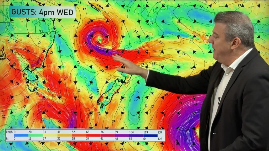
A large low covering much of the Tasman Sea and NZ area will remain for most of the working week and next weekend, dropping more rain and showers across NZ (and some southern snow in the mountains).
The low looks likely to weaken and break apart gradually this week – but the remnants may reform going into Saturday and Sunday as it slowly tracks back across New Zealand (like it did last Friday). And this may still change too. But modelling has been consistent with the low lingering for several days now.
This means airflows will shift – so temperatures and sky conditions will also shift from wet and grey to dry and sunny, warm or cold, depending on the day of week and region you’re in. The messy forecast is a continuation of what NZ has had since Thursday last week.
Due to blocking high pressure surrounding the low it’s possible this low pressure zone will linger across NEXT week as well, bringing this low pressure zone to an impressive 14 day run affecting New Zealand’s weather. Long range modelling suggests the sub-tropics may be active late June as well (not locked in) – which could see even more rain falling across the country.
It’s a big shift from May’s pattern which was dominated by equally slow moving high pressure zones.
As we’ve said in our previous monthly ClimateWatch updates, the neutral season we’re in now (ie, no La Niña or El Niño) means NZ’s weather is often chaotic and messy and not driven by one particular pattern. May and June have certainly shown that now.
Rainfall totals this week will still be high enough for slips and flooding in some places – and isolated thunderstorms too. Because of the complicated nature of this low, rainfall totals (and forecasts) are expected to continue to shift around a bit. Forecasting fractured rain bands and shifting air pressure can be a bit like throwing a handful of coins on the ground – you know they will fall and cover the floor but it’s tricky to say precisely where each coin will land. These unpredictable showers and rain bands can be a little bit like that, and each hourly update we have tries to calculate the precise placement of wet weather – and that’s why totals can shift around. The ‘big picture’ rain maps may also change due to moving airflows, but you’ll get the general idea – there’s more off and on rain coming for NZ over the next week or two.


- WeatherWatch.co.nz
Comments
Before you add a new comment, take note this story was published on 16 Jun 2024.


Add new comment
millsy on 16/06/2024 5:49pm
You never seem to publish or answer any of my questions. I think they a reasonable. People love sunshine, and they want to know when they will get it. So, tell us. WHEN ARE WE GETTING IT?!
Reply
WW Forecast Team on 16/06/2024 7:37pm
Because A) You keep asking the same question day after day. B) As the rules state above, we don’t answer questions already answered in our news stories, forecasts and videos. Your question is something we have no answer for – you don’t seem to understand this is the weather NZ gets. It’s called Aotearoa – “land of the long white cloud” for a reason!
– WW
Reply
Debz on 17/06/2024 12:40am
👏👏👏💯
Reply