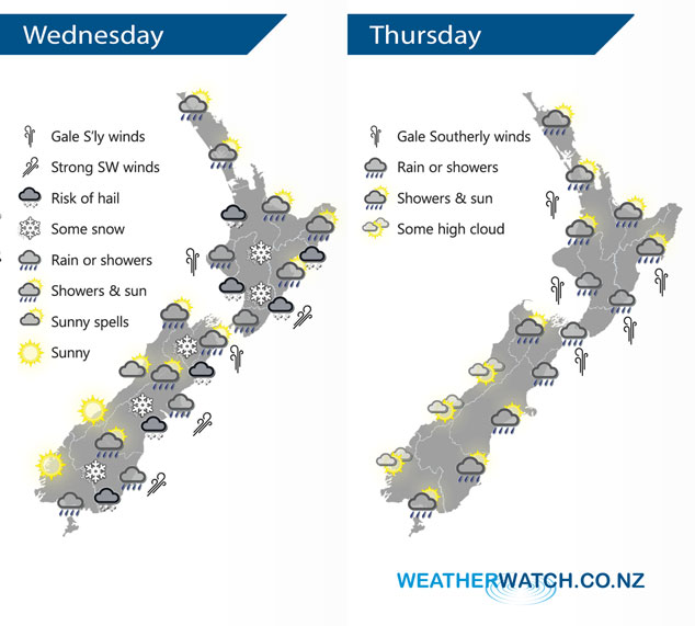
InfoGraphic: The Big Picture for Wednesday / Thursday
5/06/2018 7:00pm

> From the WeatherWatch archives
A strong cold southerly airflow over the South Island spreads northwards over the North Island during today. A large high sits in the Tasman Sea on Thursday directing a southwesterly airflow over New Zealand, a warm front pushes northwards over the country during the day.
Rain or showers for most regions today, there may be hail at times also. Some inland parts of the South Island may stay quite sheltered apart from an initial burst of precipitation this morning. Snow to low levels (200 to 100m) from Southland through to Canterbury, 400m about Marlborough through to the Central North Island in the evening.
Winds blustery and cold from the south or southwest, gales through Cook Strait.
A shower or two for the upper North Island on Thursday, many long dry areas also especially in the east. Showers more prevalent for the lower North Island, a period of rain moves through around midday then eases in the evening. Some snow about the Central Plateau down to 500m for a time. Mostly sunny along the West Coast of the South Island, just some high cloud. In the east expect a period of rain to push northwards during the morning for Canterbury and Marlborough then easing late afternoon, just a shower or two expected about Southland and Otago.

By Weather Analyst Aaron Wilkinson – WeatherWatch.co.nz
Comments
Before you add a new comment, take note this story was published on 5 Jun 2018.


Add new comment