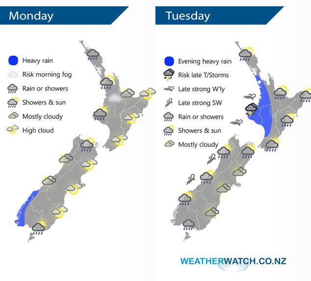
InfoGraphic: The Big Picture for Monday / Tuesday
12/08/2018 7:00pm

> From the WeatherWatch archives
A ridge slips away from the North Island today then northerlies build over New Zealand during the day, a front pushes in from the west in the evening. A low pressure system gradually passes over New Zealand on Tuesday moving from west to east, winds from the north changing to the southwest during the evening and overnight.
Rain moves into Northland this afternoon then pushes southwards over the upper / western North Island this evening. Mostly sunny weather in the east with some high cloud. A dry day for the eastern South Island also with some high cloud, the odd shower moves into Nelson from afternoon then rain develops there overnight. Rain about Fiordland may be heavy at times today.
Early rain eases to showers for the western North Island on Tuesday, in the evening rain picks up with heavy falls and thunderstorms possible. For the east coast early rain clears then becoming mostly sunny, in the evening scattered falls may move in again spreading from the west. For the South Island expect rain or showers in the north, west and south, the east coast doesn’t really see widespread rain or showers till overnight.

By Weather Analyst Aaron Wilkinson – WeatherWatch.co.nz
Comments
Before you add a new comment, take note this story was published on 12 Aug 2018.


Add new comment