Monday Newsfeed: Hotter & windier weather moving up NZ ahead of cold front
19/02/2024 12:57am

> From the WeatherWatch archives
It’s a warm to hot Monday across a large portion of the North Island and east to north eastern South Island ahead of an incoming cold front.
Many places will be between 25 and 32 degrees as windy west to north west winds build ahead of the front. They will be windiest today, mostly through central and eastern regions.
Wellington and Dunedin, however, will be slightly cooler (and windier than most other main centres). Dunedin’s high drops to only around 13c on Tuesday.
Southland, Otago, Westland and Fiordland will be first to receive the rain – and rain clouds will weaken as the system heads northwards.
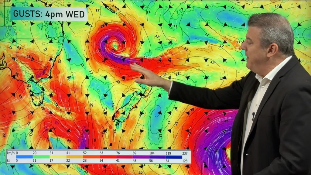
Weather Maps most relevant today are…
- Thank you for backing a small Kiwi business up against two tax funded commercial Government forecasters.
- Please DOWNLOAD our new FREE App!
- Upgrade to the paid PRO Alerting version to create your own Customisable Weather Alerts – YOU set the criteria for your own push alert notifications!
- WeatherWatch.co.nz / RuralWeather.co.nz / New App
Comments
Before you add a new comment, take note this story was published on 19 Feb 2024.
Latest Video

NZ 8 Day: High pressure to return, also monitoring tropics next week
A cooler change is moving into NZ tonight and Saturday then winds ease further on Sunday as high pressure starts…
Related Articles
NZ 8 Day: High pressure to return, also monitoring tropics next week
A cooler change is moving into NZ tonight and Saturday then winds ease further on Sunday as high pressure starts…

Unsettled Thu/Fri, high pressure returns this weekend & next week
Wind and some wet weather is moving into both ends of NZ today and tomorrow bringing broken up rain bands…
Subtropical low, windy for some, then high pressure slowly returns
It’s cloudy and windy for parts of New Zealand today with the North Island especially gloomy under cloud associated with…


Add new comment