> From the WeatherWatch archives
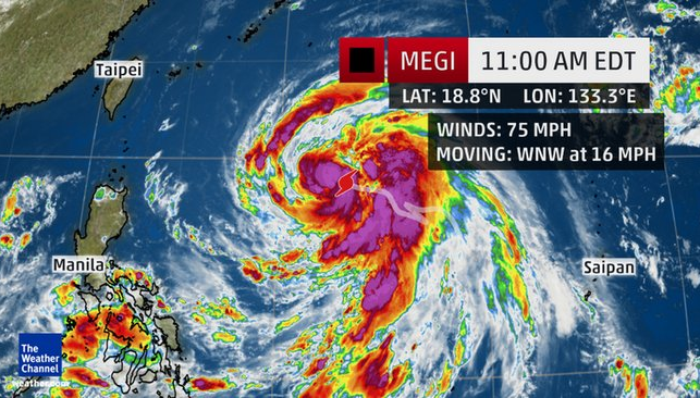
Megi is now a typhoon in the western Pacific Ocean, around 800 miles east-southeast of Taipei, Taiwan.
A recent flurry of typhoons in the western Pacific has been very unnerving for residents of Taiwan and the northern Philippines, and it looks like yet another threat is looming.
Conditions are favorable for Megi to gain strength, and it will be steered in the general direction of Taiwan early next week.
According to the Joint Typhoon Warning Center, Megi will be steered toward the west-northwest and then the northwest around the southern periphery of a subtropical ridge.

The atmospheric and oceanic environments are favorable for this tropical system to develop and intensify. Wind shear is light and ocean temperatures are in the mid-80s.
This track should take Megi toward Taiwan early next week. The forecast from the Joint Typhoon Warning Center indicates that Megi could make landfall in southern Taiwan on Monday night or early Tuesday (EDT).
Megi has become a typhoon, and the forecast is for it to become equivalent to Category 2 or 3 hurricane in strength. Mainland China could also feel impacts from Megi by midweek.
It looks like it will move along at a steady pace. All interests in these areas should become aware of the situation and make preparations if necessary.

– Wunderground
Comments
Before you add a new comment, take note this story was published on 24 Sep 2016.


Add new comment