Weather Video: High pressure trying to build but another windy, cold, blast coming
20/06/2018 11:01pm

> From the WeatherWatch archives
Rain and gloomy conditions will finally clear the north of NZ today with high pressure building for Friday and Saturday in many areas.
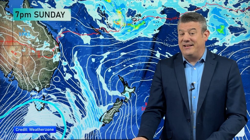
But the centre of the high is way over in Australia so expect a few showers this weekend with rain on Sunday returning to the West Coast and snow developing in the mountains.
Also on Sunday will be a windier change with westerlies (mild in the north of the country) turning colder sou’west later in the South Island bringing snow. It may get even colder on Tuesday nationwide. High pressure looks to move in after that, around mid week.
Comments
Before you add a new comment, take note this story was published on 20 Jun 2018.
Latest Video

NZ: Spring gales, temp drops (& spikes) + Fiji has a tropical low to monitor
We have our first forecast for Christmas Eve & Day today, but this coming week looks spring-like as a colder…
Related Articles
NZ: Spring gales, temp drops (& spikes) + Fiji has a tropical low to monitor
We have our first forecast for Christmas Eve & Day today, but this coming week looks spring-like as a colder…

Windy westerlies return next week + Vanuatu/Fiji tropical cyclone risk update
(No video Friday, next update is on Sunday) — NZ has a cooler/colder change coming in on Friday as a…
Southerly coming Friday, windy westerlies to return next week + Tropical cyclone update
A colder change is coming for southern NZ later on Thursday and into Friday, with a southerly flow going nationwide…


Add new comment