Weather in Pictures: Rough conditions in parts of NZ, here are 10 Maps that explain it
21/07/2020 8:16pm

> From the WeatherWatch archives
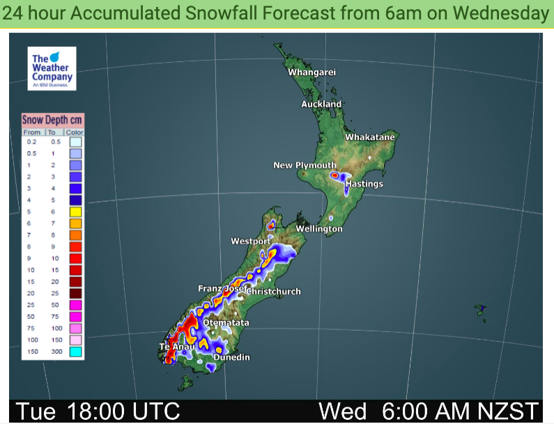
A somewhat wintry snap is moving up over the country although most places have average temperatures today.
Snow is in the mountains and some lower level snow flurries around Southland and Otago – but accumulations won’t be much lower down or towards the east where it will be significantly drier.
A surge of gales around Auckland, Northland and Coromandel Peninsula today as well.


These maps are Exclusive to WeatherWatch.co.nz
Need more data? Drill down deeper with NZ’s largest weather data website: www.RuralWeather.co.nz
Comments
Before you add a new comment, take note this story was published on 21 Jul 2020.


Add new comment