Weather headlines (x3) for Wednesday: Far south stays dry, Low deepens overnight, Frost potential coming up
19/07/2022 7:00pm

> From the WeatherWatch archives
Here’s what is making the weather headlines today.
FAR SOUTH STAYS DRY
Many regions around New Zealand are looking to experience rain or showers today, it’s probably more interesting to spot out the one place that stays dry. Southland and a fair chunk of Otago look to stay mainly dry today but while that sounds nice it’s looking quite cloudy with temperatures sticking below 10 degrees. Parts of North Otago may see a few light drizzle patches at times.

LOW DEEPENS OVERNIGHT
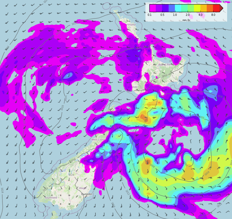
A low deepens east of New Zealand overnight with some heavy rain developing for the lower North Island, some heavy rain may spread into North Canterbury on Thursday morning. Southwesterly winds strengthen overnight about Canterbury through to Wellington / Wairarapa, winds rise to gale about the coast, possibly severe gale on Thursday morning.
For any potential warnings that may come out regarding this low check out Metservice’s warnings here.

MSLP / Rain map – Thursday 21st July 3:00am 2022 – WeatherWatch.co.nz 
Wind map – Thursday 21st July 9:00am 2022 – WeatherWatch.co.nz
IF SKIES ARE CLEAR, THERE SHALL BE FROSTS
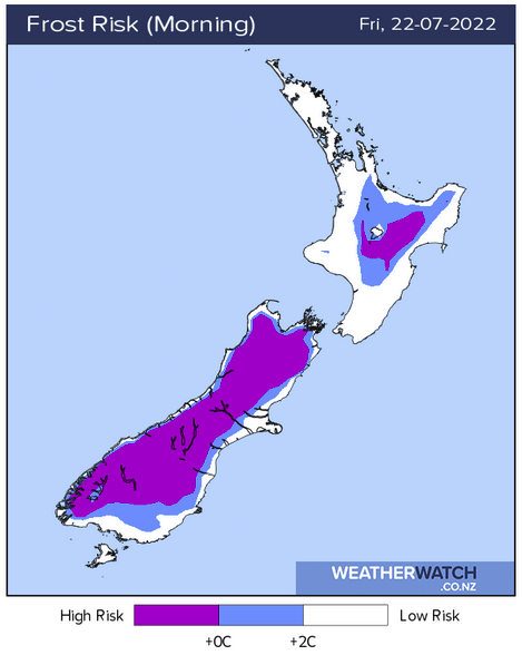
Friday morning on wards sees a chance of heavy frosts about some inland areas, especially the inner South Island if skies are clear and winds are light enough. Check out this page here for the frost potential coming up.

Comments
Before you add a new comment, take note this story was published on 19 Jul 2022.


Add new comment