Weather headlines (x3) for Saturday: Troublesome weather this weekend, Eastern regions drier, Any warmth out there?
10/06/2022 7:00pm

> From the WeatherWatch archives
Here’s what is making the weather headlines today.
PLENTY OF TROUBLESOME WEATHER THIS WEEKEND – SNOW, THUNDERSTORMS, HAIL, STRONG WINDS
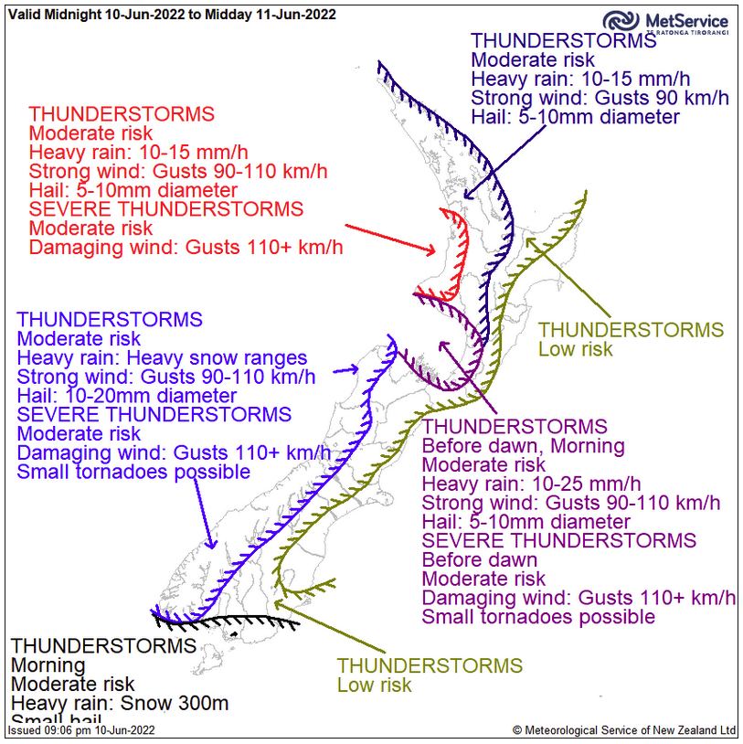
We’ve nearly got it all this weekend in the rough weather department. Thunderstorms and hail for western regions at times, snow about the Main Divide and for the far south today getting down to 200m.
Westerly quarter winds will be strong across the country today, tomorrow very strong northerly quarter winds develop ahead of a front which moves onto the lower South Island in the morning then reaching the North Island later in the evening.
For details on watches and warnings for this weekends weather check out this page here. Also Metservice’s thunderstorm outlook here.

EASTERN REGIONS DRIER THAN OUT WEST
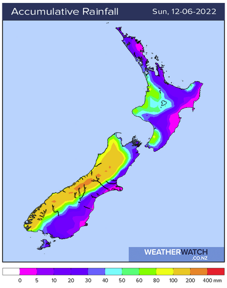
If you are looking for some dry weather this weekend, eastern regions will likely be drier than out west due to the westerly airflow over us. As frontal systems move through some rain will spread eastwards at times though.
While it may be drier in the east you probably won’t be able to escape the wind.

Map shows: Combined Total Precipitation (mm) this weekend 
Wind map 3pm Saturday 
Wind map 3pm Sunday
ANY WARMTH OUT THERE?
Naturally temperatures will be warmer the further north one travels this weekend, Hawkes Bay and Gisborne will be the warmest spots today with highs in the late teens or early twenties likely. Sunday may see temperatures reach into the late teens again.
By contrast, Southland will see temperatures ranging between 5 and 10 degrees.
Comments
Before you add a new comment, take note this story was published on 10 Jun 2022.


Add new comment