Weather headlines (x3) for Friday: Strong front tonight, Snow to 200m Southland on Saturday, Strong front again Sunday
9/06/2022 7:00pm

> From the WeatherWatch archives
Here’s what is making the weather headlines today.
STRONG FRONT THIS EVENING
A very strong front moves into the South Island from later this afternoon or evening, it will bring heavy rain to the West Coast with thunderstorms and hail, scattered falls will likely spread to the east coast. Very strong northwesterly winds develop ahead of the front spreading over the South Island with gales likely about alpine areas and perhaps Canterbury northwards in the east. Also it goes without saying that Cook Strait will get gale northwesterlies this evening too.
Check out the latest watches and warnings from Metservice here. Also check out today’s thunderstorm risks here.

Friday 6pm Rain map 
Friday 9pm Wind map
SNOW TO 200M IN THE FAR SOUTH ON SATURDAY, SEA LEVEL SNOW IN FIORDLAND
Some cold air moves over Southland and Otago on Saturday with heavy snow getting to 300m and lighter falls possible to 200m for a time before clearing in the evening. Some isolated flurries may go even lower and sea level snow is forecast in Fiordland.
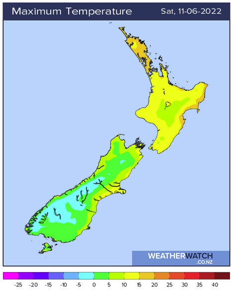
Highs for Southland and Otago on Saturday will range between 4 and 6 degrees, maybe coastal Otago could get a little warmer around 8 to 9 degrees. Either way it’s not looking all that warm.

ANOTHER STRONG FRONT DUE ON SUNDAY
Yes another strong front is moving through on Sunday, heavy rain with thunderstorms and hail is likely in the west as it moves northwards, scattered falls spread eastwards. North to northwesterly winds ahead of the front are likely to be strong with gales developing for many.
Keep up to date with the latest watches and warnings from Metservice as we move forward here.

Comments
Before you add a new comment, take note this story was published on 9 Jun 2022.


Add new comment