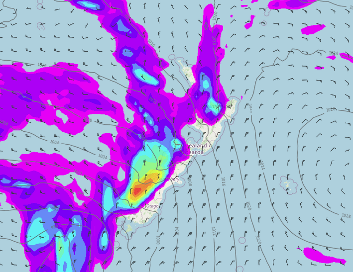
Weather headlines (x3) for Friday: Southwesterlies today, Weekend starts off settled, Next week unsettled
2/06/2022 7:00pm

> From the WeatherWatch archives
Here’s what is making the weather headlines today.
SOUTHWESTERLIES MOVE IN
A change in direction today as southwesterlies spread northwards over the country, naturally this will bring a drop in temperatures. Showers may be beefy for the western North Island, perhaps even a few rumbles then easing this evening.


WEEKEND STARTS OFF SETTLED AND FROSTY
High pressure moves in over the country tomorrow bringing settled frosty weather, there is still a few clearing showers for the North Island though. Coromandel then Auckland later in the day sees showers thanks to a trough.


NEXT WEEK LOOKING UNSETTLED
The majority of next week looks fairly unsettled with a westerly quarter airflow pumping in fronts at times, rain or showers are likely in the west while it is looking drier and a touch warmer in the east. Strong northerly quarter winds ahead of a front moving through on Tuesday.
Thunderstorms will likely occur for western regions when fronts move through, especially on Tuesday, Wednesday and Thursday. The West Coast has a higher chance of storms on average than the western North Island.
This map below shows where it is wetter than average (blue) over the next 7 days and where will be drier (red). Clearly the western side of NZ has some wet weather coming up while it is a bit drier in the east. Although the eastern North Island may get average rainfall especially when heading into Hawkes Bay and Gisborne.


Comments
Before you add a new comment, take note this story was published on 2 Jun 2022.


Add new comment