VIDEO: Severe frosts for some in the SI, showers for eastern NI & Far North
31/07/2024 12:42am

> From the WeatherWatch archives
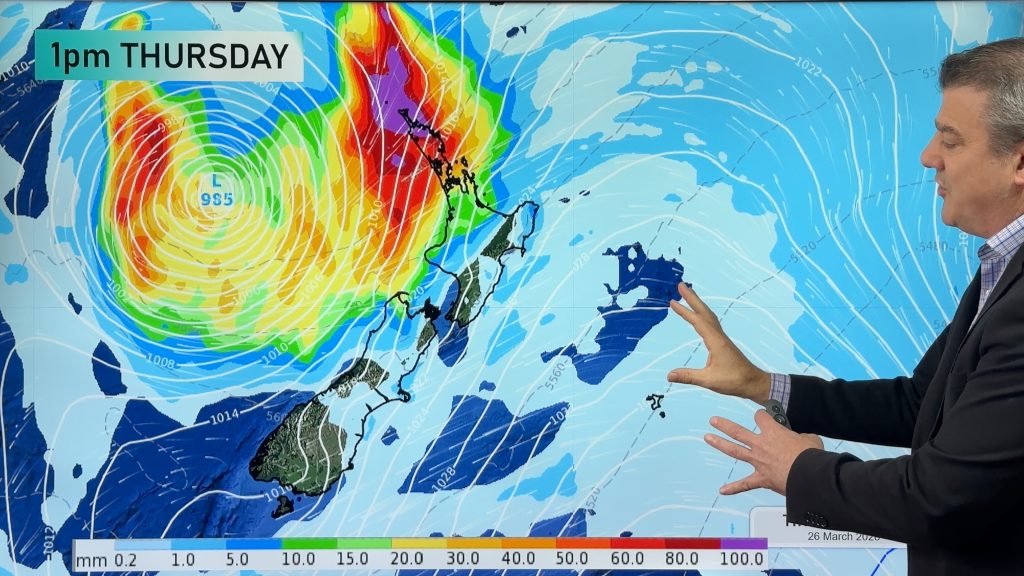
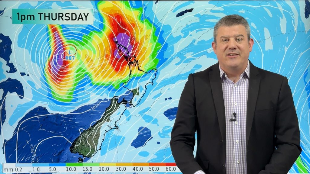
High pressure will expand over NZ in the coming days which means moderate to severe frosts across the South Island, and more wintry showers for the eastern side of the South Island up to about East Cape.
A low pressure zone will remain stuck for days just north of NZ bringing rain, showers (and maybe some isolated heavy falls) to the Far North and the northern end of Northland.
Frosty weather in the South Island will expand into the North Island this weekend.
By Tuesday next week colder but drier air heads into Auckland and Northland, while a slightly milder westerly kicks into the lower SI.
Overnight lows in the South Island will be anywhere from around 0 to -10C in places where people live and farm.
Comments
Before you add a new comment, take note this story was published on 31 Jul 2024.
Latest Video
Tropical storm to bring severe weather to NZ, gales & heavy rain
A tropical cyclone is today leaving the tropics and will grow into a larger storm system for a time in…
Related Articles
Tropical storm to bring severe weather to NZ, gales & heavy rain
A tropical cyclone is today leaving the tropics and will grow into a larger storm system for a time in…
Tropical low to bring wind & rain this week
A low exiting the tropics near New Caledonia this week will grow larger in the Tasman Sea and finally bring…

High pressure grows, but a stormy end to next week possible
A settled weekend is on the way and apart from a few isolated showers in both main islands many regions…


Add new comment