VIDEO: Early spring westerlies to surge off & on for two weeks
25/08/2024 11:49pm

> From the WeatherWatch archives
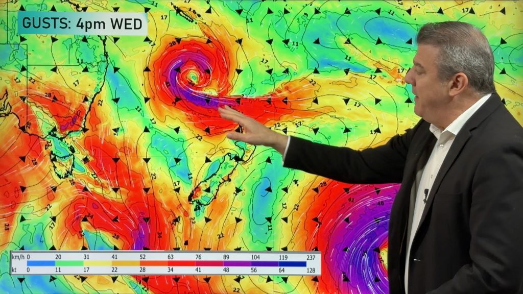
Westerly winds are going to surge off and on and reach severe gale force in some locations over the next week or two as an early spring weather pattern emerges across southern Australia and New Zealand.
The unsettled weather pattern means heavy rain at times for the West Coast and around Mount Taranaki and the Tararua Ranges, however for many other places rainfall this week maybe below average with above normal temperatures.
Severe weather warnings are likely – for the potential of damaging gales and some heavy rain.
We have your forecast across New Zealand through until Sunday.
Comments
Before you add a new comment, take note this story was published on 25 Aug 2024.
Latest Video

NZ 8 Day: High pressure to return, also monitoring tropics next week
A cooler change is moving into NZ tonight and Saturday then winds ease further on Sunday as high pressure starts…
Related Articles
NZ 8 Day: High pressure to return, also monitoring tropics next week
A cooler change is moving into NZ tonight and Saturday then winds ease further on Sunday as high pressure starts…

Unsettled Thu/Fri, high pressure returns this weekend & next week
Wind and some wet weather is moving into both ends of NZ today and tomorrow bringing broken up rain bands…
Subtropical low, windy for some, then high pressure slowly returns
It’s cloudy and windy for parts of New Zealand today with the North Island especially gloomy under cloud associated with…


Add new comment
Enrico Monteclaro on 26/08/2024 1:03am
How long is this windy weather in Wellington going to last for this spring?
Reply
WW Forecast Team on 26/08/2024 7:35am
That’s a bit like asking how long is a piece of string! Wellington is usually windy quite frequently right across Spring… it is the windiest city on earth after all 🙂
– WW
Reply
janet on 26/08/2024 12:21am
hi phil it would be nice to see the rain amounts please .we have had floods in the hutt valley and wellington thankyou
Reply
WW Forecast Team on 26/08/2024 7:35am
Hi Janet: https://www.weatherwatch.co.nz/maps-radars/rain/cumulative-rainfall
– WW
Reply