VIDEO: Australasia – 4 named cyclones, Queensland still most exposed
25/02/2025 11:40pm

> From the WeatherWatch archives
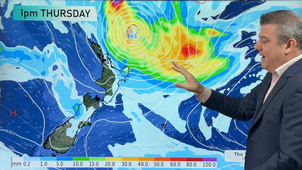
We’re tracking 3 tropical cyclones and 1 ex-tropical cyclone around Australia, New Zealand and the south Pacific over the coming days. New Zealand is not currently at risk of these storms.
Alfred – which is over the Coral Sea – perhaps poses the biggest threat to people with the tropical cyclone potentially affecting Queensland in the week ahead, although the tracking isn’t yet locked in.
This video is focusing on tropical storms – on Thursday we’ll have our usual NZ and Australia only videos and we’ll have more information about these tropical cyclones in those updates.
As always, keep up to date with official warnings from the Fiji Met Service and BoM.
Comments
Before you add a new comment, take note this story was published on 25 Feb 2025.
Latest Video
Subtropical low (yes, another one) to brush the NI, high pressure still in charge
A subtropical low will power up over the next 24 hours and brush past the north-eastern corner of the North…
Related Articles
Subtropical low (yes, another one) to brush the NI, high pressure still in charge
A subtropical low will power up over the next 24 hours and brush past the north-eastern corner of the North…
NZ weather: Skies will get drier before they get any wetter
High pressure is the main feature of New Zealand’s weather this week, the upcoming weekend and likely kicking off next…

NZ 8 Day: High pressure to return, also monitoring tropics next week
A cooler change is moving into NZ tonight and Saturday then winds ease further on Sunday as high pressure starts…


Add new comment
Alfred Watcher on 26/02/2025 4:46pm
Hi Duncan. Big fan here. Just wondering why you’re placing so much emphasis on GFS which is low resolution for this neck of the woods. usually european and Access models are better?
Reply
WW Forecast Team on 26/02/2025 8:18pm
Hi there, high resolution doesn’t make the overall mapping more accurate if they have the placement of low and high pressure incorrect in the first place… then it just becomes a more detailed map of something incorrect. That’s why GFS works better for our global videos in our view – and the maps go out for much longer. They are both very similar in accuracy, both have weak and strong points – and we tend to use ECMWF when we’re super focused on showers, or a cyclone coming in. But longer range or day-to-day the extra resolution isn’t always helpful and can make the maps look very messy. Hope that makes sense!
Cheers Phil D
Reply