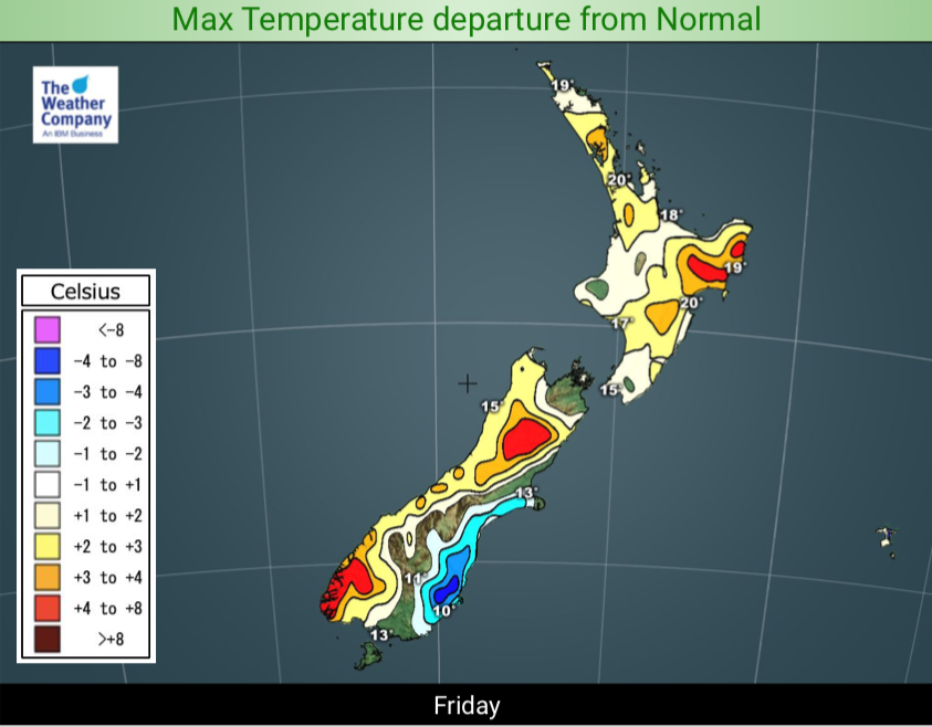
Upcoming Rain, snow and temperature trends next few days (+4 Maps)
16/10/2019 6:52pm

> From the WeatherWatch archives
Another low is about to affect NZ, this time it’s a South Island event for the most part bringing a very wet end to the week on the West Coast – and it kicks off a number of days of western rain showers and gusty westerlies.
It means, generally speaking, most of New Zealand is warmer than average with the exception of Southland and Otago.
Snow is fairly limited to the South Island mountains and the bulk of the rain is focused on the West Coast – keep up to date with any tax funded warnings from MetService.
Winds will be blustery at times in the days (weeks) ahead but will also help keep temperatures above normal for many regions too.
Don’t forget – stop being surprised by the weather at your place – drill down for what this means for you with the most weather data freely available in New Zealand, all from www.RuralWeather.co.nz!!
3 DAY RAINFALL TO 7AM SUNDAY:


– WeatherWatch.co.nz
Comments
Before you add a new comment, take note this story was published on 16 Oct 2019.


Add new comment