Typical ‘peak spring’ weather this week – wintry at times, warm by Saturday (+8 Maps)
21/10/2019 12:20am

> From the WeatherWatch archives
Spring is an aptly named season. The temperatures this week will be springing around with a wintry drop this week and a summer-like boost for some this weekend.
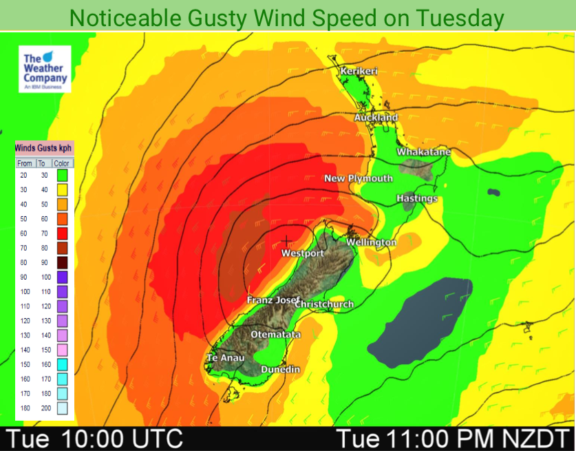
The week ahead is a cold one for Southland and on Wednesday the eastern South Island and most of the North Island gets a cool down with below average daytime highs, windy weather and even some hail about.
The colder air in the South Island will see heavy mountain rain falling as snow, possibly falling as low as just 400m or so, which may impact a few highways – although nothing too major is forecast at lower levels. Wind chills for newborn lambs (any late ones) will also be tough for a time, but again nothing too brutal (considering what is possible). Farmers with concerns should use our new RuralWeather.co.nz local weather page to drill down to see what this week means in great detail for your farm (or orchard). RuralWeather.co.nz has been designed to help you get fewer weather surprises – and to make sense of news stories like this one on a very local level, including hourly wind chill forecasts for livestock out for 10 days. (Please note, the first time you visit this site the data may take 10 seconds to fully load – we’ll be fixing this in the near future).
This week put simply, Tuesday sees a below average day temperature-wise in Southland but average to warmer than average elsewhere. Wednesday sees the eastern half of the South Island and much of the North Island colder than average. By Thursday the cold becomes confined to the lower South Island again and by the end of Friday and going into Saturday a warm nor’westers with subtropical and Australian connections moves in and lifts temperatures above 20 degrees in a number of southern and eastern spots.
Gore has a high of 8 degrees on Thursday but 20 degrees on Saturday – to give you an example. Likewise parts of Hawke’s Bay are only 12 degrees on Wednesday – but early 20s during the long weekend.


72 HOUR SNOWFALL FORECAST (To 7am Thursday)
72 HOUR RAINFALL FORECAST (To 7am Thursday)
– WeatherWatch.co.nz
Comments
Before you add a new comment, take note this story was published on 21 Oct 2019.


Add new comment