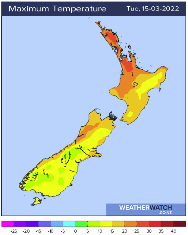
Tuesday’s weather headlines (x3): Temperatures set to cool, Rain for Northland soon? Cold nights inner South Island later this week
14/03/2022 6:00pm

> From the WeatherWatch archives
TEMPERATURES SET TO COOL FOR THE EASTERN SOUTH ISLAND
As a southerly airflow pushes up the east coast of the South Island today temperatures are sure to cool. Invercargill has a high of 13 degrees, Dunedin 15, Christchurch is a bit warmer on 18 but when we move to Reefton we have a very pleasant 25. Nelson is 22 and would be a touch warmer if not for a sea breeze (northerly) this afternoon.
The western North Island is very nice too getting into the mid twenties, Hamilton may reach 27.

SOME RAIN FOR NORTHLAND THIS WEEKEND?
Not to get hopes up too high but medium to long range models are hinting at some rain for Northland this coming weekend or early next week. It’s a bit hard to nail down any exact details yet but it is something we’ll have to watch as we move forward. If anything the rain will be associated with a low in the Tasman Sea, it will move in with a northeasterly airflow.
The below map is the precipitation percentage of normal map through to the 22nd March, red is drier than normal and blue is wetter than normal. As we can see Northland is looking a shade of blue especially in the east.

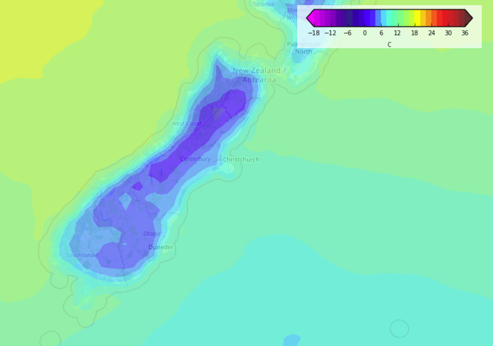
COLD NIGHTS THU / FRI / SAT / SUN INNER SOUTH ISLAND
High pressure and clear skies leads to cold overnight lows for the inner South Island towards the end of this week, this is mainly pertaining to inland areas and up the main divide. Coastal areas may experience a bit of cloud so this could prevent temperatures dropping all that low across the Canterbury Plains for example. One may wake to a temperature sitting around 3 or 4 degrees inland but 1 or 2 is possible in isolated areas especially for the likes of Twizel.

Comments
Before you add a new comment, take note this story was published on 14 Mar 2022.


Add new comment