> From the WeatherWatch archives
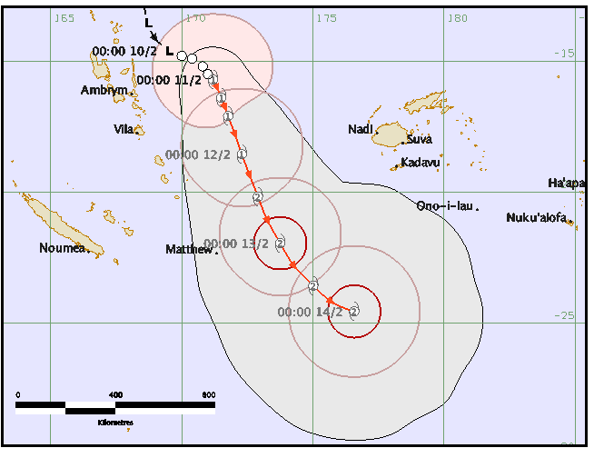
As expected a tropical cyclone has today formed east of Vanuatu. Tropical Cyclone Winston has been named by Fiji forecasters.
It’s currently a Category 1 cyclone and modelling suggests it may become a severe tropical cyclone for a time – although recent data updates show it may move quite quickly south – limiting it’s chances to grow much more. A strong Category 2 or weak Category 3 (which would make it severe) is quite likely according to WeatherWatch.co.nz.
The central air pressure is currently 995hPa with sustained gale force winds at the centre. Sustained winds at the centre of the low will increase to 85km/h later today according to the first warning out of the Fiji Met office.
Sometimes cyclones can slow down over warmer waters and rapidly intensify – other times they can zig-zig as they track in one direction overall, and this zig-zagging nature can move the centre of the storm over cooler waters or unfavourable air pressure and this can quickly weaken a storm too.
Cyclone Winston may not last too long as a cyclone, but it’s still expected to generate dangerous seas north of the country which may impact northern New Zealand beaches early next week.
More details from WeatherWatch.co.nz on Friday.

Above/Below: Fiji Met Service, 4pm Thurs NZT.

Comments
Before you add a new comment, take note this story was published on 11 Feb 2016.


Add new comment