Tropical Cyclone Niran intensifying (+5 Maps)
2/03/2021 8:56pm
> From the WeatherWatch archives
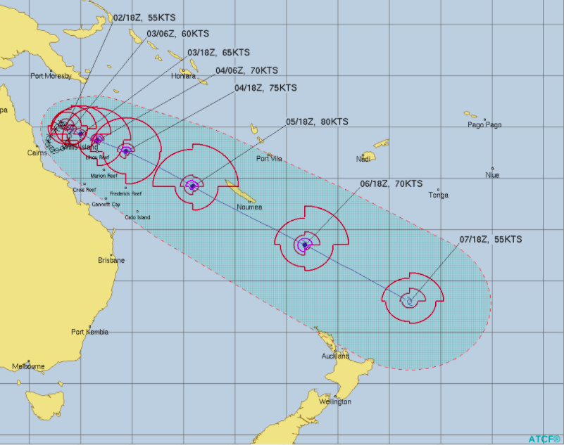
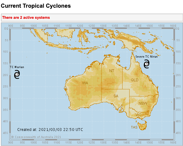
Cyclone Niran remains in the Coral Sea area.
It will continue to bring rain, wind and rough seas to parts of Queensland, but in the day or two ahead will start to pull off the Australian coastline and more out to sea.
It’s currently over sea surface temperatures of 29.5 degrees C which is ripe for fuelling a tropical storm.
New Caledonia is expecting to get a direct impact by the cyclone this weekend, with damaging gales and flooding rains – also coastal inundation and erosion is possible. The cyclone may impact the entire nation.
As for New Zealand, the risk looks low of a direct threat due to growing high pressure in the Tasman Sea area and a big southerly flow over the NZ area. The Chatham Islands may end up getting some of the leftovers as it possibly combines with a much larger southerly low that is expected to intensify this weekend in the NZ area.


Comments
Before you add a new comment, take note this story was published on 2 Mar 2021.
Latest Video

Spring-like until Christmas (NZ’s 11 Day forecast!)
Severe gales, heavy West Coast rain, and temperature fluctuations are on the way as spring weather returns following a much…
Related Articles
Spring-like until Christmas (NZ’s 11 Day forecast!)
Severe gales, heavy West Coast rain, and temperature fluctuations are on the way as spring weather returns following a much…

NZ: Spring gales, temp drops (& spikes) + Fiji has a tropical low to monitor
We have our first forecast for Christmas Eve & Day today, but this coming week looks spring-like as a colder…

Windy westerlies return next week + Vanuatu/Fiji tropical cyclone risk update
(No video Friday, next update is on Sunday) — NZ has a cooler/colder change coming in on Friday as a…


Add new comment