Thursday’s weather headlines (x3): Cool southwesterlies, Mainly settled from tomorrow, Low next week
6/04/2022 7:00pm

> From the WeatherWatch archives
Here’s what is making the weather headlines today.
COOL SOUTHWESTERLIES, HIGH NUDGING IN FROM THE TASMAN SEA
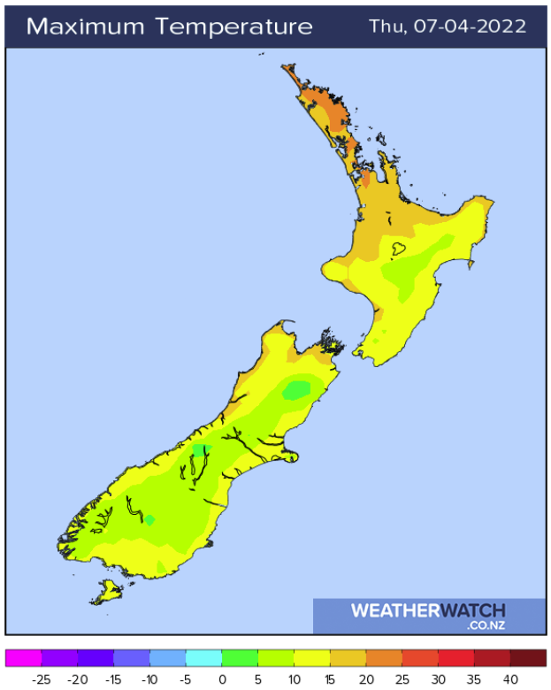
South to southwesterly winds bring cool temperatures to many regions today especially in the east, high’s for the eastern South Island are generally in the mid teens, eastern North Island late teens.
The West Coast reaches into the late teens and the upper North Island will be a bit cooler than it has been lately but still not that bad with high’s in the early twenties.

MAINLY SETTLED TOMORROW AND THE WEEKEND
Thanks to high pressure the weather should be mainly settled for Friday and this weekend, some cloud could bring a shower or two to western regions and the far south on Friday but otherwise we are looking good. But with settled weather comes the chance of frosts like inland parts of the South Island may have experienced this morning. For more on the frost risk coming up for you please check out this link here.

LOW FROM THE NORTH MID NEXT WEEK
What will be Ex Tropical Cyclone Fili looks to head down towards New Zealand now about mid next week, this is more of an update on how the current situation is looking in modeled data however this could still change. At this stage the low wants to move past the northeastern side of the North Island bringing some unsettled weather to that part of the country. Please check out these maps here for the very latest. More on this in tomorrow morning’s outlook.

Comments
Before you add a new comment, take note this story was published on 6 Apr 2022.


Add new comment