Warming up a touch in the east on Sunday
5/08/2023 11:00am

> From the WeatherWatch archives
Here’s your Sunday outlook…
WARMING UP IN THE EAST ON SUNDAY, A LITTLE
Temperatures pick up a little in the east on Sunday as a westerly quarter airflow develops, nothing overly hot, we are still in winter after all, but a touch warmer than Saturday. Highs should reach into the low to mid teens.
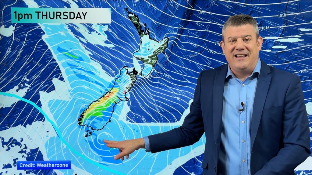
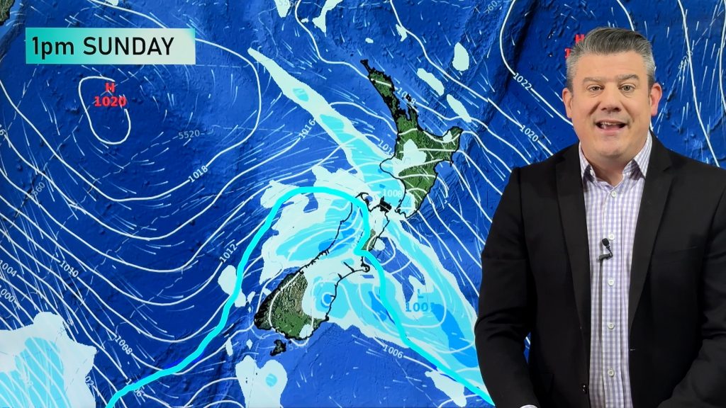
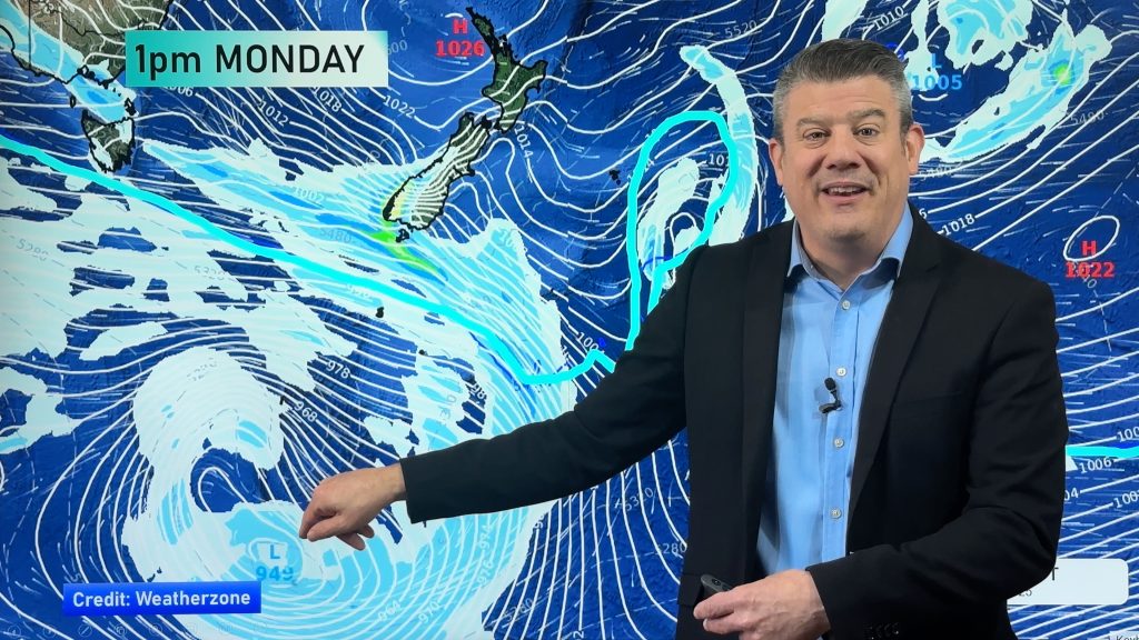
But usually when temperatures pick up in the east a touch it means something lurks to the south, and this is no exception. A cold front brings heavy rain to Fiordland from morning, showers about Southland in the afternoon and a few showers or spits may reach Otago in the evening. Overnight the front moves northwards with rain moving in tandem along the West Coast but it does weaken. Monday is when we see rain or showers move northwards in the east.


MSLP / Rain map – Sunday 6th August 2023 12:00pm – GFS Weatherzone.com.au 
MSLP / Rain map – Monday 7th August 2023 12:00pm – GFS Weatherzone.com.au
GENERAL WEATHER ON SUNDAY
High pressure for the North Island today, a trough north of about Auckland brings showers. A west to northwesterly airflow for the South Island with a cold front moving into the far south then moving northwards later today / overnight.
North Island
Mostly cloudy north of about Auckland with occasional showers, expect cloud in the southwest (Taranaki through to Wellington) with showers there in the evening. Mostly sunny elsewhere with morning cloud clearing Gisborne, afternoon cloud south of Napier. Winds are mainly light tending westerly in the west.
South Island
Mostly cloudy for the West Coast, the odd shower. Heavy rain for Fiordland eases from late afternoon, rain pushes northwards along the West Coast from evening but weakening. Cloud for Nelson and Marlborough breaks to afternoon sun, chance of a shower about the Sounds. Mostly sunny in the east but expect some high cloud. Thickening cloud about the far south, a few spits or showers for Southland in the afternoon, northwesterly winds. Overnight showers push in from the south with a southwest change.
- WeatherWatch.co.nz / RuralWeather.co.nz – IBM Business Partners.
Comments
Before you add a new comment, take note this story was published on 5 Aug 2023.


Add new comment