> From the WeatherWatch archives
Weather conditions are much drier this morning across much of Queensland as sunrise nears says WeatherWatch.co.nz.
The latest rain radar shows about 90% of the state is starting the morning off dry, with just Mackay and Cairns seeing significant shower activity.
WeatherWatch.co.nz says high air pressure has moved in to help calm conditions down.
Weather conditions across the rest of Australia arean’t so settled, however. Yesterday saw flash flooding hit Victoria in a totally unrelated weather system that brought the heaviest deluge in 100 years for some parts.
Meanwhile a large low is moving over the desert and Tropical Cyclone Vince has formed to the north west of the red continent.
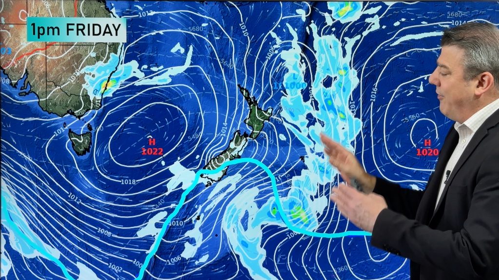
To the north east of Australia another tropical cyclone has formed, this one is called Vania. WeatherWatch.co.nz says that between Vania and a large high in the Tasman Sea cloud and strengthening south easterlies should move in to Queensland but conditions will should be drier and less humid.
Vania is not expected to reach Australia, instead New Caledonia is expected to receive a direct hit in the next day or two with the tropical depression likely to reach New Zealand between Tuesday and Thursday of next week.
– WeatherWatch.co.nz
Comments
Before you add a new comment, take note this story was published on 12 Jan 2011.


Add new comment
sw on 13/01/2011 8:08am
I remember Bola,in Auckland the winds were gusty mostly from the east/southeast for a couple of days,there were sparodic light showers at times and average to mild temperatures.
Reply
Glenda on 12/01/2011 7:28pm
I see there is still some debate about the track of this cyclone. NZ Met Service sees it tracking east of NZ on Tues/ Wed and ECMWF forcasts for it to track directly to top on North Island on Sunday/Monday. What do you think? My bet is for it to go east better for us here at the top of the north.
Reply
WW Forecast Team on 12/01/2011 7:47pm
Hi Glenda,
Still a fair amount of confusion with the models on this one. We have a story about it at 10am so check back then, but at this very early stage we still think it will cross Northland, most likely on Wednesday.
– WW
Reply
Andrew on 12/01/2011 8:42pm
Hi guys… My guess it will cross Northland not far from Auckland as a strong Cat 1 or a weak Cat 2 Wednesday ish…..
Andrew
Reply
Dave on 12/01/2011 11:33pm
Not sure why you would guess category 1-2 cyclone, which would be severe (sustained speeds 120kph+). It is incredibly rare for a cyclone to reach NZ still classified as Category 1. By the time it reaches NZ it will be an ex-tropical cyclone, and much weaker than a Cat 1
Reply
Andrew on 13/01/2011 1:44am
What about Bola Dave…… Can you give me all the infomation you know about it since your the expert….. Yes I know it rear to get these storms down this way but they do still happen and Bola is proof that it can Happen…… Andrew hit Florida after Florida hadn’t had a Hurricane in over 20 odd years and the same with New Orleans with Katrina. It was also many decades for Houston with Rita….
I know its been decades since 1988 with Bola but all im saying is “if it happened once it can happen again”
Andrew
Dave if you have any info on what Auckland experienced with Bola I would love to know….. A lot of people can’t seem to remember it……
Reply
Dave on 13/01/2011 2:16am
I’m just wondering what were your reasons for thinking Cat 1-2. None of the models yet support the cyclone being particularly intense as it crosses the country…
Reply
Andrew on 13/01/2011 2:43am
Dave Just a gut feeling……. Looking at the models it just looks like were overdue for another Bola…..
I don’t want to see anyone lose there homes here or anything but when its been sooooo many years since Bola people have this view of they wont come here…. It will miss…. It will weaken etc….. One day it wont miss and wont weaken……
Thats my view…… Remember No one thought Christchurch would have an Earthquake and that happened…..
All im saying is were overdue for another Bola
Andrew
Reply
WW Forecast Team on 13/01/2011 2:52am
Hi Andrew,
Yes we probably are overdue for a Bola type storm, but this one – certainly at this stage – looks like it will be moving through fairly fast. Which means even if it does have enough rain with it, it won’t be here for long enough to cause the type of damage Bola caused.
In saying that, it’s still far too early to know for sure where it will go exactly – but the models seem to agree it will move through within 24 to 48 hours.
Cheers!
Phil
Reply