Temperature trends – Windy westerlies with average to cool overnight lows
15/09/2020 4:00am

> From the WeatherWatch archives
A westerly airflow lies over New Zealand tonight, while this can bring warmer than overnight lows to eastern regions the atmosphere over the country at present isn’t particularly warm. Still, the winds should keep frosts away again but it will feel a bit chilly in the wind.
Tonight’s warmest overnight lows go to parts of Northland (mainly coastal) and Auckland on 12 to 13 degrees. The coldest temperatures will be about inland parts of the South Island getting down to 1 to 3 degrees.

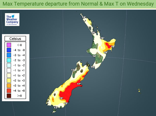
Windy westerlies continue on Wednesday, this time however upper air temperatures are warm also and this leads to warmer high’s for eastern regions. High’s getting into the late teens or perhaps even early twenties for Otago Peninsula northwards right up to Gisborne. Tomorrow’s coldest high goes to Fiordland on 11 degrees, not far behind is Southland and other parts of the West Coast getting up to 13 degrees.

For Max & Min NZ Temperature maps for the next few days and nights ahead, please visit our new maps page: https://www.weatherwatch.co.nz/maps-radars/temperature/temperature
By Weather Analyst Aaron Wilkinson – WeatherWatch.co.nz
Comments
Before you add a new comment, take note this story was published on 15 Sep 2020.


Add new comment