Temperature trends – Northwest airflow brings warmer than average temperatures for most
21/09/2020 4:00am

> From the WeatherWatch archives
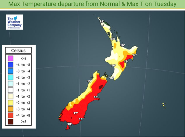
A northwesterly airflow lies over New Zealand tonight, continuing a pattern we had last week of spring westerly quarter winds. Some parts of the North Island (especially Waikato northwards) may be a touch cooler than normal due to a ridge of high pressure. Warmer than normal about some parts of the South Island especially Southland due to northwesterlies.
Wellington sees tonight’s warmest overnight low, Mackenzie Country sees the coolest getting down to between 2 and 0 degrees.

The northwest airflow shows itself tomorrow with plenty of red in the map below for eastern regions, especially in the South Island. High’s will reach into the late teens or early twenties for eastern regions, tomorrow’s lowest highs will be along the West Coast of the South Island ranging between 13 and 14 degrees.

For Max & Min NZ Temperature maps for the next few days and nights ahead, please visit our new maps page: https://www.weatherwatch.co.nz/maps-radars/temperature/temperature
By Weather Analyst Aaron Wilkinson – WeatherWatch.co.nz
Comments
Before you add a new comment, take note this story was published on 21 Sep 2020.


Add new comment