Temperature trends – Departing ridge brings cooler than average overnight lows for some in the north
5/08/2020 4:13am

> From the WeatherWatch archives
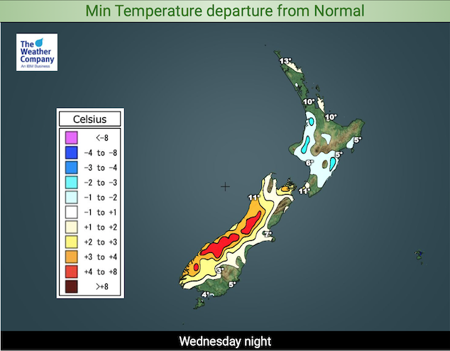
A ridge of high pressure clinging to the North Island brings cooler than average overnight lows for some tonight, central parts of the North Island may dip to 2 degrees by dawn on Thursday. The same goes for inland parts of the upper and lower South Island, 2 degrees possible overnight. The warmest overnight low temperature goes to Northland once again on 13.

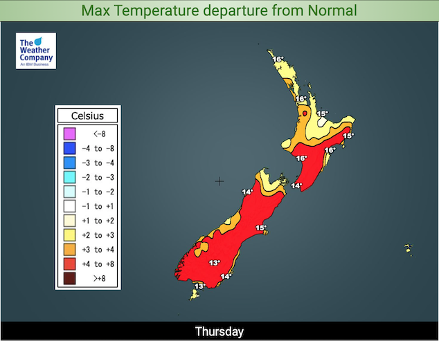
More warmer than normal day time highs can be expected on Thursday. Temperatures reaching into the mid teens for many, possibly up to 17 to 18 degrees for Canterbury, Hawkes Bay, Gisborne and parts of Northland.
Conditions begin to turn on Friday though as the airflow starts to tilt to the southwest, Saturday certainly has a cooler feel about it.

For Max & Min NZ Temperature maps for the next few days and nights ahead, please visit our new maps page: https://www.weatherwatch.co.nz/maps-radars/temperature/temperature
By Weather Analyst Aaron Wilkinson – WeatherWatch.co.nz
Comments
Before you add a new comment, take note this story was published on 5 Aug 2020.


Add new comment