Temperature trends – Bitterly cold for the southeastern South Island on Tuesday
28/09/2020 3:00am

> From the WeatherWatch archives
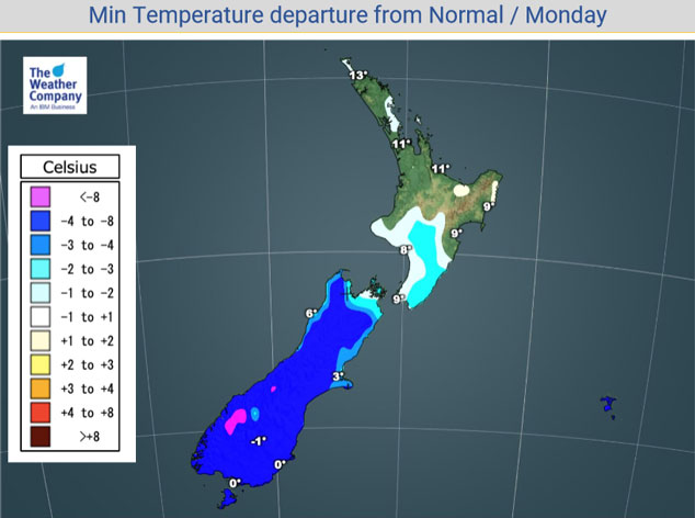
There’s not too much you can really do to disseminate the situation any further then to say tonight, tomorrow and going into Wednesday conditions will be very cold. This is especially true for the South Island tonight as can be seen in the map below. Most of the South Island is 4 to 8 degrees below normal overnight tonight, some mountainous parts of Fiordland are even colder than 8 degrees below normal.
Lows of between -3 to -6 are likely about the inner South Island, northern Northland is the warmest overnight spot on 12 or 13 degrees.

And yes we continue the cold theme tomorrow, this time cold temperatures spread into more of the North Island. Look at the southeastern corner of the South Island in particular though, bitterly cold temperatures can be expected there with highs not getting past 3 or 4 degrees. Tuesday’s warmest spot will be either Gisborne or northern Northland on around 16 to 17 degrees.

For Max & Min NZ Temperature maps for the next few days and nights ahead, please visit our new maps page: https://www.weatherwatch.co.nz/maps-radars/temperature/temperature
By Weather Analyst Aaron Wilkinson – WeatherWatch.co.nz
Comments
Before you add a new comment, take note this story was published on 28 Sep 2020.


Add new comment