Sunday’s national forecast – Cloudiest in the east (+8 Maps)
20/03/2021 3:00pm

> From the WeatherWatch archives
The equinox was last night at 10:37pm and from now on the nights start to get longer than the days.
Weather-wise, a powerful high pressure system remains parked between Tasmania and Fiordland with New Zealand on the eastern side of the centre.
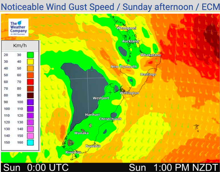
A southerly quarter wind flow moves up the country and this brings cloudiest weather in to the east of both main islands. But a small low east of Gisborne will help contribute more cloud, more wind and more showers into that northeastern corner of the North Island.
These areas, like coastal Hawke’s Bay and Gisborne, will be cooler than average too.
The rest of the country is dry with fairy light winds, sunniest weather looks to be in the west and inland.
Check your LOCAL and HOURLY forecasts for more details at both WeatherWatch.co.nz or over at RuralWeather.co.nz. Have a great Sunday!


Comments
Before you add a new comment, take note this story was published on 20 Mar 2021.


Add new comment