Sub-tropical low to bring rain, then colder change late week (+8 Maps)
3/09/2019 2:15am

> From the WeatherWatch archives
Airflows from the sub-tropics means New Zealand has more mild weather in the days ahead with plenty of rain clouds sliding south.
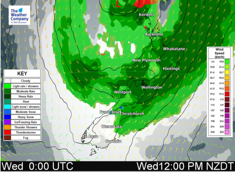
Clouds will thicken today from the north and slide southwards with a few showers or drizzle patches. Plenty of dry areas too. High pressure still remains over much of the country but the sub-tropical low will bring rain into Northland today (already falling there) and will slide south slowly towards Auckland, Waikato and Coromandel Peninsula later this afternoon or tonight.
There are ‘somewhat’ strong winds around it which, in the right exposed places may make it to gale force and above but for the most part shouldn’t be too problematic. Gustiest winds will be from the north east this evening and will likely be most blustery around the eastern Waikato hugging the western Kaimai and Coromandel Ranges.
Rain then moves southwards down across the country over the next two days before departing on Thursday.
After that we get the colder south to south west change (blustery on Thursday in some northern areas to the west like Auckland and Northand). The colder change further south will bring some snow into the mountains and ranges and a drop in temperatures this Friday and weekend nationwide.
Here’s what you need to know – and remember our new website www.RuralWeather.co.nz has all the weather data and graphs you’ll ever need, all entirely free to access for the rest of 2019 and specific to where you live, work or play.


– WeatherWatch.co.nz
Comments
Before you add a new comment, take note this story was published on 3 Sep 2019.


Add new comment