> From the WeatherWatch archives
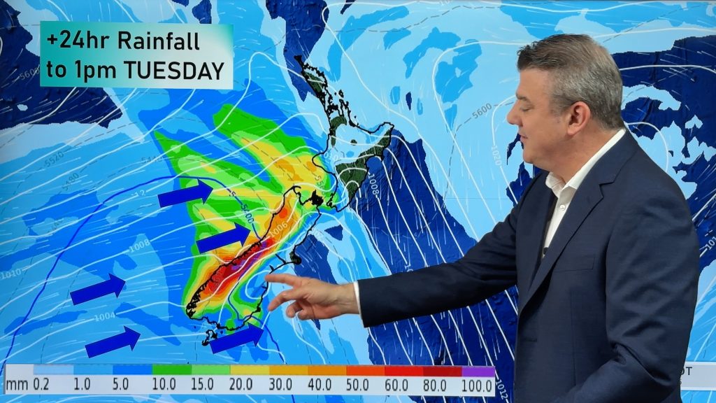
The Kapiti Coast, Wairarapa and other areas of the lower North Island have been hit by severe weather overnight and this morning, resulting in widespread flooding.
As NZME reported earlier this afternoon flooding across the North Island today has affected a number of highways.
 Colin McArley inspecting floodwaters around his house on Waikawa Beach Road, north of Otaki. Photo / Mark Mitchell
 Cattle stranded by floodwaters near Waikawa Beach, north of Otaki. Photo / Mark Mitchell
 Flooed farmland near Waikawa Beach, north of Otaki. Photo / Mark Mitchell
Farmer Kris Trass said his house in Mauriceville, Masterton was “totally surrounded” by a moat of floodwater and was using a quad bike to get in and out of the property.
“The sheep and everything are stuck up around the house and I had to save the pig who was swimming in water,” he said.
SEND IN YOUR PICTURES TO NZME’s NEWSDESK
The flooding had been caused by willows in the river by the property, which he had been trying to get the local council to clear.
“I’ve been onto the Masterton District Council and the Wellington Regional Council and they reckon it’s not their problem, when it’s obviously their waterway,” he said.
“I’ve even got myself in there and cut a whole bunch of trees out around our part of the river.
“They’ve done south of Mauriceville and they reckon everyone paid into a rates scheme to get it done and I said, ‘well why can’t we do that north of Mauriceville’ and they didn’t want to know about it.”
 Motorists ignoring the sign advising State Highway One is closed at the Waikawa Bridge. Photo / Mark Mitchell
 A newly resealed section of Waikawa Beach Road. Photo / Mark Mitchell
His neighbour’s paddocks were also badly flooded and rain was starting up again.
Many roads around the district have been closed due to surface flooding.
State Highway 1, north of Manakau in Horowhenua, was closed as floodwaters had undermined the banks of the Waikawa Stream Bridge, the NZTA said.
Pictures sent in by a reader show the bridge had collapsed.
The NZTA said crews were working to reinstate the bridge and are hopeful of reopening it today.
Motorists have been advised to use SH2 and SH3 as a diversion.
Surface flooding had closed the Calico Line on SH1 between Bulls and Hunterville, with no diversion in place.
As wet conditions and surface flooding are widespread, the NZTA urge motorists to take great care while travelling.
“Slippery roads are much more dangerous, as they can turn minor errors into major problems,” says Mr Owen.
“Heavy rain and wind can also result in debris on the road, so keep your eyes peeled for any obstructions.”
Otaki and Te Horo
The bridge at Ringawhati Road in Otaki was washed out and the water main severed. The severed water main has now been repaired, but up to 35 properties may be affected for a short while.
The bridge will remain closed for the weekend, but alternate routes are available.
Surface flooding has also closed Convent and Bennett Roads in Otaki. Tasman Road, Atkinson Road and Riverbank Road were also affected by floodwater.
Feilding
Wastewater systems were overloaded due to flooding, Manuwatu District Council said. Floodwater was in the sewerage network and was being monitored.
Residents are warned to not use their toilets if the water is yellow or backing up.
Roads closed in the Manuwatu area include: Awahuri-Feilding Road, Sandon Road – Ranfurly Road to Lees Road, Fagan Road, Campbell Rd and Waugh Road, Kawakawa Road, Campbell Road/Waugh Rd intersection, SH 54 Cheltenham – SH1, Tangimoana Road – Campion Road to Taylor Road.
 Flooding near the Bridal Track walkway by Waterloo Cres in the Manawatu, Palmerston North. Photo / Alan Toner
Martinborough
The SH53 Waihenga Bridge in Martinborough has been closed, with diversions in place.
Whanganui
People are advised by Wanganui District Council to keep away from floodwaters, which may be contaminated with sewerage.
Heavy rain has caused flooding in slips in areas of Putiki, Aramoho, Wanganui East and St Johns Hill.
A number of roads have closed in the area and there are reports of manholes popping. The Council are asking people to drive only if essential and take care on the roads.
In Whanganui East, the Matarawa stream is rising rapidly. This will cause flooding and sewerage contamination in properties around the Anzac Parade and Nile Street area. The Red Cross are talking to people in the affected areas.
There have been power outages in some parts of the city, with outages to about half of the 24 pump stations. Wanganui District Council have no information about when power is likely to be back on, but have reduced water pressure at the Kai Iwi bore and are asking residents to conserve water.
The Whanganui River is expected to reach 11.3 metres at Pipiriki around 6pm or 7pm tonight and peak water is expected to reach urban areas around 6am to 7am tomorrow morning. Further flooding on the Whanganui River Road is expected.
Fourteen people from Putiki and Brunswick have been evacuated by the Red Cross.
For more information regarding road closure, see the NZTA website here.
– NZME.
Comments
Before you add a new comment, take note this story was published on 20 Jun 2015.


Add new comment