Saturday’s national forecast – Showers in the far north and far south (+8 maps)
30/07/2021 4:00pm

> From the WeatherWatch archives
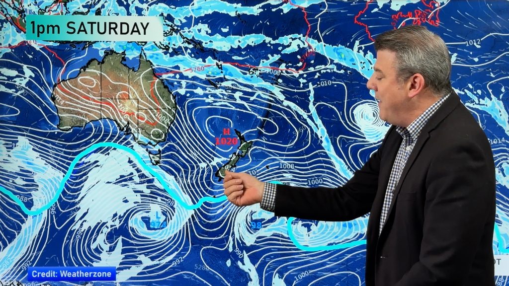
An area of low pressure rolls over the top of the North Island today away to the east, with it comes some rain for northern Northland and showers for northeastern parts of the North Island. Most of the South Island is dry but about the southwestern corner there is some rain or showers.
Please refer to your local, hourly, 10 day forecast for more details.
Northland, Auckland, Waikato & Bay Of Plenty
Cloudy areas for Waikato and Bay Of Plenty, perhaps a light shower (mainly morning) and some sun breaking through in the afternoon. Northland can expect a mostly cloudy day with showers, northern Northland sees some rain. Auckland may be mainly dry with just high cloud, still the risk of a shower though especially afternoon. Breezy east to northeasterly winds tend southeast later in the day or overnight.
Highs: 16-17
Western North Island (including Central North Island)
Mostly sunny, some high cloud. Light easterly quarter winds.
Highs: 14-17
Eastern North Island
Morning low cloud or fog then expect sunny spells, cloud may thicken up again in the evening with a light drizzle patch or two. East to northeasterly winds.
Highs: 15-16
Wellington
Mostly sunny with some high cloud, light winds.
Highs: 16-18
Marlborough & Nelson
Any morning low cloud clears then mostly sunny with some high cloud, light winds.
Highs: 15-17
Canterbury
Any morning cloud breaks then expect high cloud, staying mainly dry. East to northeasterly winds.
Highs: 11-14
West Coast
Mostly cloudy, rain or showers south of the Glaciers, further north expect high cloud. Light winds.
Highs: 12-16
Southland & Otago
Mostly cloudy with occasional showers, especially in the west. Coastal Otago may have fairly dry day but still the risk of a shower or two. Southwesterly winds.
Highs: 11-13


Comments
Before you add a new comment, take note this story was published on 30 Jul 2021.


Add new comment