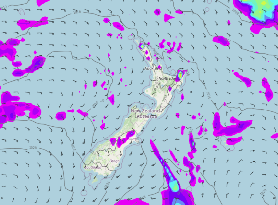
Saturday’s national forecast – Cold front moves northwards
25/02/2022 11:01am

> From the WeatherWatch archives
A cold front pushes northwards over the South Island today, it is fairly weak though bringing showers in the east as it moves through. The North Island is mainly settled then this evening southerlies freshen in the east bringing showers.
Northland, Auckland, Waikato & Bay Of Plenty
Any early cloud clears then mostly sunny, perhaps a few coastal showers for parts of Northland clearing in the morning also. In the afternoon cloud builds a little and there is the risk of an isolated shower late afternoon / evening mainly for Northland. Light winds then afternoon sea breezes.
Highs: 24-26
Western North Island (including Central North Island)
Any early morning cloud breaks away then mostly sunny, some evening cloud though as light winds change southeast.
Highs: 20-23
Eastern North Island
Morning cloud, chance of a shower then sunny spells breaking through. Mid to late afternoon a few isolated showers develop in the ranges behind Hawkes Bay and Gisborne then in the evening southerlies spread through with showers becoming a little more widespread.
Highs: 23-24
Wellington
Sunny with northerly winds, late afternoon or evening southerlies bring cloud and a few showers.
Highs: 21-23
Marlborough & Nelson
Mainly sunny with light winds, evening southerlies bring cloud and a few showers (mainly to southern Marlborough), staying dry elsewhere.
Highs: 22-23
Canterbury
A mostly sunny morning then southwesterlies freshen in the afternoon bringing showers.
Highs: 18-22
West Coast
Morning showers for Fiordland then clearing away, elsewhere can expect a mix of sun and cloud with southwesterlies freshening in the afternoon.
Highs: 21-26
Southland & Otago
Showers for Southland, pushing into Otago during the morning then sunny spells increase from afternoon as showers clear away, breezy southwesterlies ease overnight.
Highs: 15-17
Comments
Before you add a new comment, take note this story was published on 25 Feb 2022.


Add new comment