Road Weather: Driving hazards across NZ today
8/06/2022 10:12pm

> From the WeatherWatch archives
Surface water, snow and strong winds look to be the main driving risks in the days ahead as a Southern Ocean storm brings a variety of severe weather to New Zealand.
All South Island Alpine Passes are expected to get snow in the coming days and some chance the Desert Road of the North Island will get a dusting by Tuesday (although the North Island isn’t as impacted by colder air as the South Island is).
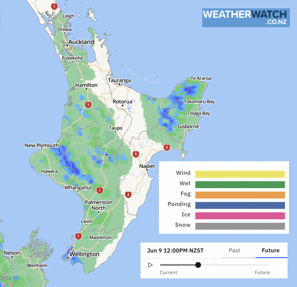
These maps show the main threat to drivers today – mostly slippery roads, ponding/surface water from heavier downpours and isolated thunderstorms, and some snow in the mountains of the South Island.
Here are the general risks at 12 Noon Thursday across New Zealand’s highways.


WARNINGS & ALERTS:
– You can find all official MetService warnings and watches LIVE here on our website.
– For all local alerts (weather, roading, police etc), we recommend lert.info.
Comments
Before you add a new comment, take note this story was published on 8 Jun 2022.


Add new comment