Rainfall numbers: How much has fallen, how much more is coming up (+2 Maps)
28/04/2019 10:45pm

> From the WeatherWatch archives
New Zealand has had plenty of rain events in the past few weeks and is helping slowly chip away at the nation’s dry zones.
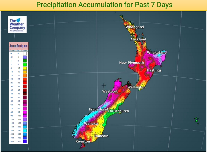
The West Coast has once again been affected the most with 250-300mm falling over a large portion of the western Southern Alps in just the past week. Dry areas like Southland, Manawatu and Waikato have also had some relief and are getting more today but totals for some are below 20 or even 10mm in some pockets.
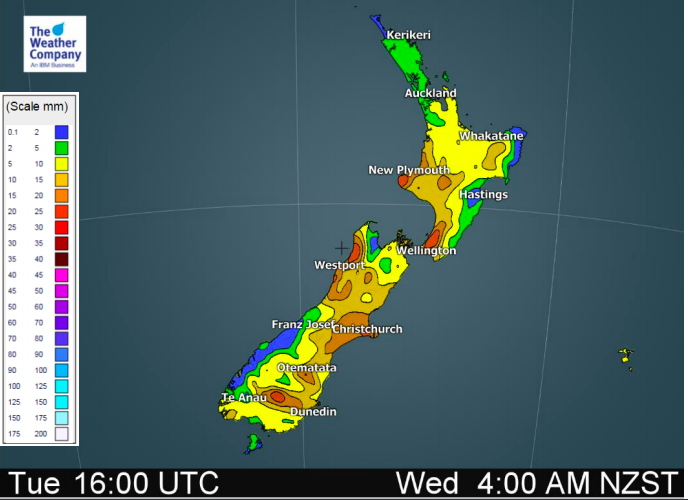
Below are two rainfall maps. The first covers the past 7 days, the second covers the next 48 hours. Please note the bulk of the rain coming over the next 48 hours will be falling today, Monday, with some heavy downpours in the mix too.
HISTORIC: PAST 7 DAYS (up until 4am this morning)
FORECAST – FORECAST 48 HOURS (From 4am Monday to 4am Wednesday)
– WeatherWatch.co.nz
Comments
Before you add a new comment, take note this story was published on 28 Apr 2019.


Add new comment
Guest on 29/04/2019 5:39am
yeah 200 mils in four months haven’t a place like wellington and NP had that in one month
Reply