> From the WeatherWatch archives
We have a burst of wind and rain over the next couple of days and more showers in the days after.
In true spring style we a have mix of rain and snow as mild and cold air mix up around the country.
Snow looks mainly confined to the Southern Alps but some flurries may go further afield and lower down – but only briefly. Totals do not look great at lower levels (300 to 500m) but may still impact some alpine passes. Snow looks heavy higher up with possibly more than half a metre falling in some areas.
To make sense of what this means to you locally – for your farm, orchard, home or where you’re travelling to/from please visit NZ’s largest weather data website: www.RuralWeather.co.nz. (please note, first time users may take 10 seconds for the page to load all data – we are working on a fix for this!).
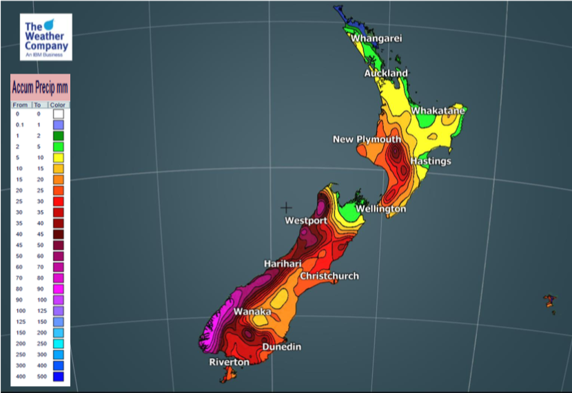
5 DAY RAIN ACCUMULATION MAP (7am Tuesday to 7am Sunday)
5 DAY SNOW ACCUMULATION MAP (7am Tuesday to 7am Sunday)
– WeatherWatch.co.nz
Comments
Before you add a new comment, take note this story was published on 21 Oct 2019.


Add new comment
Guest on 22/10/2019 6:19pm
We had a nice dumping of snow here in Oxford Canterbury overnight, everything white, including my strawberries – hopefully they’ve survived 🙂
Reply