> From the WeatherWatch archives
We have some rain and snow coming this weekend – then after that NZ enters a drier than normal period.
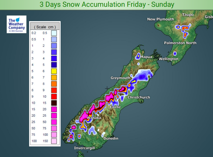
Rain will be falling on the West Coast today and into Saturday, then clears. This will fall as snow higher up and could be quite heavy on the tops of the ranges.
On Sunday it’s the North Island’s turn to get some rain and showers as a weak area of low pressure crosses by.
Next week, next weekend and potentially the week after all look drier than average at this stage thanks to an enormous block of high pressure drifting slowly towards NZ from Australia.


– WeatherWatch.co.nz
Comments
Before you add a new comment, take note this story was published on 20 Jun 2019.


Add new comment
Guest on 21/06/2019 12:13am
how do you know that high wont fizzle out like that big low you were predicting
Reply
WW Forecast Team on 21/06/2019 12:18am
Sorry don’t recall the big low you’re talking about, but this high is so enormous it won’t be fading anytime soon. The most likely scenario if we are wrong will be that the high remains “stuck” over Aussie and keeps NZ in that south west wind flow.
Cheers
Phil D
Reply
Guest on 22/06/2019 5:59am
you predicted a big low like a spider web just north of the BOP last week oh well this high might catch the metservices low they say is heading down from up north latter this week
Reply