Hurricane Milton crosses Florida as Category 1. NASA’s Cape Canaveral the exit point
10/10/2024 8:40am

> From the WeatherWatch archives
All our updates on Hurricane Milton can be found below:
Let’s get into the forecast for Thursday …
RAIN:
Showers remain over a number of North Island regions today, but especially in the southern and western sides. A few showers may sneak into the eastern North Island and also the very upper South Island. High pressure is expanding over much of the South Island which keeps many places dry there.
WIND:
Winds aren’t very strong today in most places, with westerlies in the lower South Island, and winds from varying directions around the North Island.
TEMPERATURES:
Much of the country is a little cooler than recent days but nothing too majorly cold – and in fact those in the lower half of the South Island may notice it’s a little milder today.
DAYS AHEAD
West to north west winds become stronger on Friday with gustier winds around Wellington, southern Wairarapa and Cook Strait, and a westerly quarter wind will blow through parts of the lower South Island. Lighter winds further north but a low pressure zone forming off the coast of East Cape will help create an easterly flow over the upper North Island.
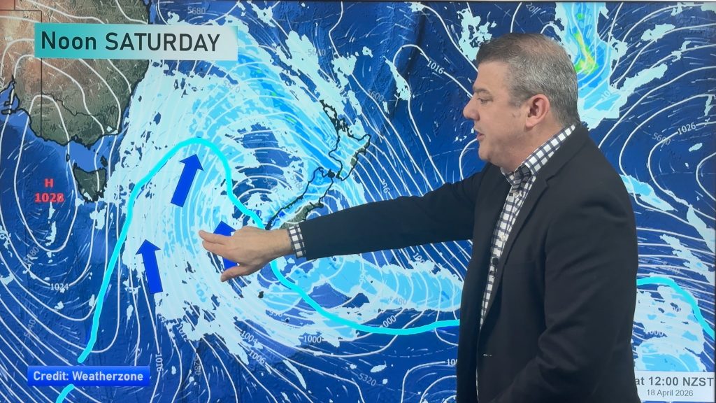
On Saturday that low drifts a little further out to sea off the east of East Cape but is worth monitoring as it might get a little more powerful and rain and wind may brush the north-eastern corner of the North Island. Meanwhile at the opposite end of the country, in the south-western corner of the South Island, then next cold front arrives.
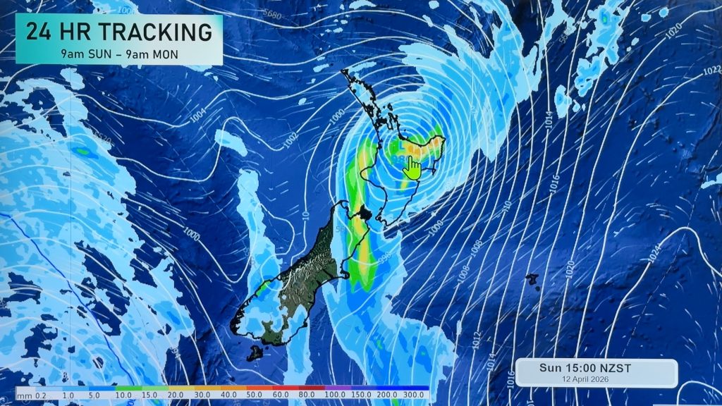
On Sunday that cold front sends a showery, cooler, change into the lower South Island – including some wet weather into Canterbury. The low east of the North Island should move away but as that cold front moves up the country (and weakens) it will spawn yet another area of low pressure, this time off the western side of the upper North Island.
And by Monday that low may be bringing showers across the North Island and upper South Island, with drier skies over the lower South Island.


Get more forecast details with the FREE hyper-local, hourly, 10 day forecasts at WeatherWatch.co.nz – or download our Free WeatherWatch App.
Comments
Before you add a new comment, take note this story was published on 10 Oct 2024.
Latest Video
Autumn westerlies kick in, large weekend low coming
This week we switch gears, shifting into a more classic Autumn weather pattern with cold fronts, windy westerlies and nor’westers,…
Related Articles
Autumn westerlies kick in, large weekend low coming
This week we switch gears, shifting into a more classic Autumn weather pattern with cold fronts, windy westerlies and nor’westers,…
NZ (SUN): Cyclone Vaianu moves across the North Island
Cyclone Vaianu made landfall in Bay of Plenty this afternoon and is now moving into Hawke’s Bay, with the centre…

NZ (SAT): Updated forecast for Cyclone Vaianu
We have the latest tracking of Vaianu as the subtropical cyclone moves into the upper North Island tonight, and across…


Add new comment